
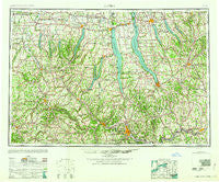
~ Elmira NY topo map, 1:250000 scale, 1 X 2 Degree, Historical, 1958
Elmira, New York, USGS topographic map dated 1958.
Includes geographic coordinates (latitude and longitude). This topographic map is suitable for hiking, camping, and exploring, or framing it as a wall map.
Printed on-demand using high resolution imagery, on heavy weight and acid free paper, or alternatively on a variety of synthetic materials.
Topos available on paper, Waterproof, Poly, or Tyvek. Usually shipping rolled, unless combined with other folded maps in one order.
- Product Number: USGS-5454837
- Free digital map download (high-resolution, GeoPDF): Elmira, New York (file size: 16 MB)
- Map Size: please refer to the dimensions of the GeoPDF map above
- Weight (paper map): ca. 55 grams
- Map Type: POD USGS Topographic Map
- Map Series: HTMC
- Map Verison: Historical
- Cell ID: 68766
- Scan ID: 138220
- Woodland Tint: Yes
- Visual Version Number: 1
- Aerial Photo Year: 1943
- Datum: NAD27
- Map Projection: Transverse Mercator
- Map published by United States Geological Survey
- Map Language: English
- Scanner Resolution: 600 dpi
- Map Cell Name: Elmira
- Grid size: 1 X 2 Degree
- Date on map: 1958
- Map Scale: 1:250000
- Geographical region: New York, United States
Neighboring Maps:
All neighboring USGS topo maps are available for sale online at a variety of scales.
Spatial coverage:
Topo map Elmira, New York, covers the geographical area associated the following places:
- Cameron Mills - Lakeview Manufactured Home Community - Perry City - Lombardo Mobile Home Community - Caledonia - Goosetree - Pine Hollow - Owasco Lake Station - Freeman - Head Corners - Tyrone - MacDougall - Baileys Settlement - Phelps Junction - Bellona - Canisteo - Garwoods - Porter Corner - Springbrook Mobile Home Park - Montour Falls - Interlaken Beach - Hicks - Fleming - Hayt Corners - Cortland - Almond - Dineharts - East Lindley - Riverside Manor - Springwater - Bennett's Mobile Court - Glenville - East Nichols - Mendon Center - Owego Heights Mobile Home Park - Unionville - Manningville - Graywood - Ford Corner - Van Vleet - Italy Hill - Orchard Knoll - Wellsville - Alpine - Avoca - Myers - Canandaigua - Picture Book Mobile Home Park - Havana Glen Mobile Home Park - Peoria - Crosby - Seeley Creek - Holton Beach - South Bloomfield - The Homes Of Wildflower Hills - Grange Landing - East Virgil - Casowasco - Kelloggsville - Ellis - Hemlock - Osgood Landing - Glenmary Mobile Home Park - West Slaterville - Old Field Mobile Home Park - Post Creek - Rough and Ready - Locke - East Geneva - Jenksville - Slab City - Mitchellsville - Poplar Beach - Black Rock - Ludlowville - Tony's Mobile Home Park - McDuffie Town - Parr Harbor - Cross Roads - Skanondaga Heights - Beacon View Village Mobile Home Park - Litchfield - Gang Mills - Asbury - Troupsburg - Browntown - Bennetts - Hunt - West Groton - Boswell Corners - Sylvan Beach - Cottage City - Maple Grove - Union Corners - Kirkwood - Rose Hill - Semans Corner - Mapleton - East Avon - Denmark
- Map Area ID: AREA4342-78-76
- Northwest corner Lat/Long code: USGSNW43-78
- Northeast corner Lat/Long code: USGSNE43-76
- Southwest corner Lat/Long code: USGSSW42-78
- Southeast corner Lat/Long code: USGSSE42-76
- Northern map edge Latitude: 43
- Southern map edge Latitude: 42
- Western map edge Longitude: -78
- Eastern map edge Longitude: -76


