
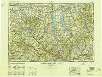
~ Elmira NY topo map, 1:250000 scale, 1 X 2 Degree, Historical, 1950, updated 1951
Elmira, New York, USGS topographic map dated 1950.
Includes geographic coordinates (latitude and longitude). This topographic map is suitable for hiking, camping, and exploring, or framing it as a wall map.
Printed on-demand using high resolution imagery, on heavy weight and acid free paper, or alternatively on a variety of synthetic materials.
Topos available on paper, Waterproof, Poly, or Tyvek. Usually shipping rolled, unless combined with other folded maps in one order.
- Product Number: USGS-5454833
- Free digital map download (high-resolution, GeoPDF): Elmira, New York (file size: 18 MB)
- Map Size: please refer to the dimensions of the GeoPDF map above
- Weight (paper map): ca. 55 grams
- Map Type: POD USGS Topographic Map
- Map Series: HTMC
- Map Verison: Historical
- Cell ID: 68766
- Scan ID: 138213
- Imprint Year: 1951
- Woodland Tint: Yes
- Visual Version Number: 1
- Aerial Photo Year: 1943
- Datum: NAD27
- Map Projection: Transverse Mercator
- Map published by United States Geological Survey
- Map Language: English
- Scanner Resolution: 600 dpi
- Map Cell Name: Elmira
- Grid size: 1 X 2 Degree
- Date on map: 1950
- Map Scale: 1:250000
- Geographical region: New York, United States
Neighboring Maps:
All neighboring USGS topo maps are available for sale online at a variety of scales.
Spatial coverage:
Topo map Elmira, New York, covers the geographical area associated the following places:
- Mead Corner - Mecklenburg - Wagon Wheel Mobile Home Park - Van Etten Junction - Hornby - King Ferry - West Caton - East Lindley - Tip Top - Owego Heights Mobile Home Park - Merrifield - Shamrock - Preble - Angus - East Homer - Rose Hill - Mertensia - Denmark - Clintonville - Browntown - Groton - Wilson Creek - Showboat Mobile Home Park - Canandaigua - Birchland Park - Candor - Conklin Cove - Marsh Corner - East Groveland - Crest View Heights - Thornton Grove - Wallace - Brookside Mobile Home Park - Fulmer Valley - Ovid - Bellona - Hartson Point - Cohocton - McLean - Honeoye - Addison - Ensenore - Chapin - Riverside Mobile Home Park - Cat Elbow Corner - Limerock - Willow Creek - Messengerville - North Almond - Tomlinson Corners - Lenox Park - Shorewood - Southport - Bunker - Crimson Mobile Home Court - Aloquin - Green Valley Mobile Home Park - Leicester - Halseyville - East Virgil - Throop - Amber - Sleggs Landing - Glenmary Mobile Home Park - Swift Corner - Jones Beach - The Mint Mobile Home Park - Picture Book Mobile Home Park - Freetown Corners - Pokeville - Asbury - South Dansville - Swain - Vincent - Gladding Corner - Graywood - Smith Valley - Corning Manor - Campville - Lake Country Estates Mobile Home Park - Reading Center - Newark Valley - Levanna - Risingville - Shaker Crossing - Stephens Mobile Home Community - Lodi - Crystal Beach - Spafford Valley - Birdsall - South Avon - Bonny Hill - Bennetts - Randall Crossing - Lombardo Mobile Home Community - Canisteo Center - Lowman - Haskinville - Southern Springs Mobile Home Park - Rock Stream
- Map Area ID: AREA4342-78-76
- Northwest corner Lat/Long code: USGSNW43-78
- Northeast corner Lat/Long code: USGSNE43-76
- Southwest corner Lat/Long code: USGSSW42-78
- Southeast corner Lat/Long code: USGSSE42-76
- Northern map edge Latitude: 43
- Southern map edge Latitude: 42
- Western map edge Longitude: -78
- Eastern map edge Longitude: -76


