
~ Buffalo NY topo map, 1:250000 scale, 1 X 2 Degree, Historical, 1973, updated 1973
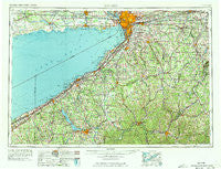
Buffalo, New York, USGS topographic map dated 1973.
Includes geographic coordinates (latitude and longitude). This topographic map is suitable for hiking, camping, and exploring, or framing it as a wall map.
Printed on-demand using high resolution imagery, on heavy weight and acid free paper, or alternatively on a variety of synthetic materials.
Topos available on paper, Waterproof, Poly, or Tyvek. Usually shipping rolled, unless combined with other folded maps in one order.
- Product Number: USGS-5454831
- Free digital map download (high-resolution, GeoPDF): Buffalo, New York (file size: 18 MB)
- Map Size: please refer to the dimensions of the GeoPDF map above
- Weight (paper map): ca. 55 grams
- Map Type: POD USGS Topographic Map
- Map Series: HTMC
- Map Verison: Historical
- Cell ID: 68695
- Scan ID: 123053
- Imprint Year: 1973
- Woodland Tint: Yes
- Visual Version Number: 1
- Field Check Year: 1962
- Datum: Unstated
- Map Projection: Transverse Mercator
- Map published by United States Army Corps of Engineers
- Map published by United States Army
- Map Language: English
- Scanner Resolution: 600 dpi
- Map Cell Name: Buffalo
- Grid size: 1 X 2 Degree
- Date on map: 1973
- Map Scale: 1:250000
- Geographical region: New York, United States
Neighboring Maps:
All neighboring USGS topo maps are available for sale online at a variety of scales.
Spatial coverage:
Topo map Buffalo, New York, covers the geographical area associated the following places:
- Balltown - Sampson - Dennison Corners - Homer Hill - Corfu - Owens Corners - Celoron - Creekside - East Eden - Allen Center - Sheldon - West Perrysburg - Lakewood - Angola - Chedwel - Lake View - Fowlerville - West Perry - Bennington - Belleview - East Aurora - Clymer - Pavilion - Murrays Corner - Inavale - Ishua Valley Estates Mobile Home Park - Willow Brook - Jolee Mobile Home Community - Wooglin - Eden - Sand Ridge - West Bethany - Portville - Boomertown - Billington Heights - Sugartown - Fredonia - Great Valley - Chipmunk - Pleasantville - South Ripley - Napoli - Vosburg - Spragues Corner - Weyer - Germantown - Forestville - Bemus Point - Waterboro - Shamrock Mobile Home Park - Arkwright - Wattsburg - Vollentine - East Pembroke - South Stockton - Blakeley - Sawyer Trailer Court - Village of Saint Anthony - Long Acres Mobile Home Park - Cottage Park - North Darien - Taylorshire - Elma Center - Loomises - Van Buren Point - Pope - Haskell Flats - Burnhams - South Attica - Pike - Wing - Lancaster - Kenilworth - Kossuth - Dellwood - Elma - Sinclairville - Scranton - Maple Grove Mobile Home Estates - Rossburg - Triton Valley Estates Mobile Home Park - Wattlesburg - Bedford Corners - Limestone - Norton Summit - Suicide Corners - Bliss - Elmhurst - Langford - Lamont - Bay View - Centralia - Hume - Ripley - Little Valley - Randolph - Quigley Park - Abbotts - Longwood - Waterfalls Village Mobile Home Park
- Map Area ID: AREA4342-80-78
- Northwest corner Lat/Long code: USGSNW43-80
- Northeast corner Lat/Long code: USGSNE43-78
- Southwest corner Lat/Long code: USGSSW42-80
- Southeast corner Lat/Long code: USGSSE42-78
- Northern map edge Latitude: 43
- Southern map edge Latitude: 42
- Western map edge Longitude: -80
- Eastern map edge Longitude: -78


