
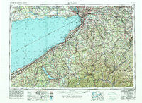
~ Buffalo NY topo map, 1:250000 scale, 1 X 2 Degree, Historical, 1962, updated 1980
Buffalo, New York, USGS topographic map dated 1962.
Includes geographic coordinates (latitude and longitude). This topographic map is suitable for hiking, camping, and exploring, or framing it as a wall map.
Printed on-demand using high resolution imagery, on heavy weight and acid free paper, or alternatively on a variety of synthetic materials.
Topos available on paper, Waterproof, Poly, or Tyvek. Usually shipping rolled, unless combined with other folded maps in one order.
- Product Number: USGS-5454827
- Free digital map download (high-resolution, GeoPDF): Buffalo, New York (file size: 19 MB)
- Map Size: please refer to the dimensions of the GeoPDF map above
- Weight (paper map): ca. 55 grams
- Map Type: POD USGS Topographic Map
- Map Series: HTMC
- Map Verison: Historical
- Cell ID: 68695
- Scan ID: 123051
- Imprint Year: 1980
- Woodland Tint: Yes
- Visual Version Number: 2
- Field Check Year: 1962
- Datum: NAD27
- Map Projection: Transverse Mercator
- Map published by United States Geological Survey
- Map Language: English
- Scanner Resolution: 600 dpi
- Map Cell Name: Buffalo
- Grid size: 1 X 2 Degree
- Date on map: 1962
- Map Scale: 1:250000
- Geographical region: New York, United States
Neighboring Maps:
All neighboring USGS topo maps are available for sale online at a variety of scales.
Spatial coverage:
Topo map Buffalo, New York, covers the geographical area associated the following places:
- Marilla - Dean - Protection - East Eden - Vukote - Greencrest - Watts Flats - Otto - East Alexander - Lambs Corner - Lehigh - Cottage Park - Hubbards Park - Shermans Bay - Panama - Colegrave - Centralia - Burnhams - South Olean - Portland - Bethany Center - Slab City - Niets Crest - Forks - Underwood Corner - Carroll - Elton - Stow - McCenithans Mobile Home Park - Black Corners - Golden Pond Estates Mobile Home Park - West Bethany - Carefree Park Estates Mobile Home Park - Bemus Point - Cheektowasa - Four Mile - Gardens of Brother Leo - Parcells Corners - Ebenezer - Kill Buck - Freeport - Spring Brook - Maple Springs - Portageville - Chace - Lombard - Onoville - Brant - Cattaraugus - Winchester - Haskell Flats - Stockton - Mills Mills - Gardenville - Bayview - Alden Village Estates Mobile Home Park - Monticello Mobile Home Park - Busti - Jewettville - The Narrows - Center Corners - North Olean - Main Settlement - Ferry Village - Toziers Corner - North Sheldon - Belleview - Stillwater - Sherman - East Ripley - Hermitage - Pembroke Center - Sardinia - Wales Center - Wesley - North Java - Eden Valley - Connelly Park - Footes - Sierks - Silver Lake Junction - South Warsaw - Aurora Mobile Home Park - Buffalo Corners - Hamburg - Willow Brook - Curriers - Cuba - Martinsville - Delhill Corners - South Vandalia - West Allen - Halls Corner - Elma - Woodlawn - Hillside Terrace Mobile Home Park - Sinclairville - Elma Center - East Koy - Greenhurst
- Map Area ID: AREA4342-80-78
- Northwest corner Lat/Long code: USGSNW43-80
- Northeast corner Lat/Long code: USGSNE43-78
- Southwest corner Lat/Long code: USGSSW42-80
- Southeast corner Lat/Long code: USGSSE42-78
- Northern map edge Latitude: 43
- Southern map edge Latitude: 42
- Western map edge Longitude: -80
- Eastern map edge Longitude: -78


