
~ Buffalo NY topo map, 1:250000 scale, 1 X 2 Degree, Historical, 1960, updated 1960
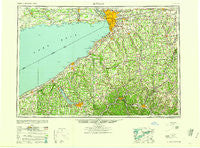
Buffalo, New York, USGS topographic map dated 1960.
Includes geographic coordinates (latitude and longitude). This topographic map is suitable for hiking, camping, and exploring, or framing it as a wall map.
Printed on-demand using high resolution imagery, on heavy weight and acid free paper, or alternatively on a variety of synthetic materials.
Topos available on paper, Waterproof, Poly, or Tyvek. Usually shipping rolled, unless combined with other folded maps in one order.
- Product Number: USGS-5454823
- Free digital map download (high-resolution, GeoPDF): Buffalo, New York (file size: 15 MB)
- Map Size: please refer to the dimensions of the GeoPDF map above
- Weight (paper map): ca. 55 grams
- Map Type: POD USGS Topographic Map
- Map Series: HTMC
- Map Verison: Historical
- Cell ID: 68695
- Scan ID: 123044
- Imprint Year: 1960
- Woodland Tint: Yes
- Visual Version Number: 1
- Aerial Photo Year: 1939
- Datum: NAD27
- Map Projection: Transverse Mercator
- Map published by United States Army Corps of Engineers
- Map published by United States Army
- Map Language: English
- Scanner Resolution: 600 dpi
- Map Cell Name: Buffalo
- Grid size: 1 X 2 Degree
- Date on map: 1960
- Map Scale: 1:250000
- Geographical region: New York, United States
Neighboring Maps:
All neighboring USGS topo maps are available for sale online at a variety of scales.
Spatial coverage:
Topo map Buffalo, New York, covers the geographical area associated the following places:
- Corfu - Shongo - Shamrock Mobile Home Park - Cottage - Bay View - Big Tree - Freedom Mobile Home Park - Varysburg - Hilltop Acres Mobile Home Park - Plato - Murrays Corner - Silver Springs - Orangeville Center - Fargo - Amherst - Lancaster - Irving - East Arcade - Caneadea - Valley View Park - Cottage Park - Shore Acres - Grover Cleveland Terrace - Griffins Mills - Saint Bonaventure - Gerry - South Cuba - Boston - Charlotte Center - Falconer Mobile Home Park - Eggertsville - Dunkirk - Johnsonburg - Eden - Wayside Mobile Home Court - Bellevue - Perry Mobile Home Park - Evans Center - Wethersfield Springs - Loomises - Portland - Crestview - Toll Gate Corner - Camp Pioneer - Hatch Court Mobile Home Park - Wales Center - Sawens - Smith Mills - Town Line Station - Protection - Blockville - Fenton - Lowville - Clymer Hill - Vosburg - New Ebenezer - North Cuba - Fillmore - Ashville - Dellwood - Lyons Corners - Sardinia - Bayview - Cold Spring - Elma - Richburg - North Gainesville - Boomertown - Frontier Mobile Home Park - Rockville - Cottage Park - Warsaw - Hardys - Short Tract - Sinclairville - Chedwel - Transit Mobile Home Park - East Aurora - Carroll - Sierks - Aristotle - Loveland - Woodhill Estates Mobile Home Park - Highland-on-the-Lake - Cheektowaga - Lake View Terrace - Jerusalem Corners - Martinsville - Shirley - West Perry - Dale - Boston Hills Estates Mobile Home Park - Aurora Mobile Home Park - Hume - Sheldon Center - Attica - Ashford - Pearl Creek - Levant - Gainesville
- Map Area ID: AREA4342-80-78
- Northwest corner Lat/Long code: USGSNW43-80
- Northeast corner Lat/Long code: USGSNE43-78
- Southwest corner Lat/Long code: USGSSW42-80
- Southeast corner Lat/Long code: USGSSE42-78
- Northern map edge Latitude: 43
- Southern map edge Latitude: 42
- Western map edge Longitude: -80
- Eastern map edge Longitude: -78


