
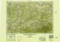
~ Binghamton NY topo map, 1:250000 scale, 1 X 2 Degree, Historical, 1950, updated 1951
Binghamton, New York, USGS topographic map dated 1950.
Includes geographic coordinates (latitude and longitude). This topographic map is suitable for hiking, camping, and exploring, or framing it as a wall map.
Printed on-demand using high resolution imagery, on heavy weight and acid free paper, or alternatively on a variety of synthetic materials.
Topos available on paper, Waterproof, Poly, or Tyvek. Usually shipping rolled, unless combined with other folded maps in one order.
- Product Number: USGS-5454815
- Free digital map download (high-resolution, GeoPDF): Binghamton, New York (file size: 18 MB)
- Map Size: please refer to the dimensions of the GeoPDF map above
- Weight (paper map): ca. 55 grams
- Map Type: POD USGS Topographic Map
- Map Series: HTMC
- Map Verison: Historical
- Cell ID: 68676
- Scan ID: 123304
- Imprint Year: 1951
- Woodland Tint: Yes
- Aerial Photo Year: 1944
- Datum: NAD27
- Map Projection: Transverse Mercator
- Map published by United States Geological Survey
- Map Language: English
- Scanner Resolution: 600 dpi
- Map Cell Name: Binghamton
- Grid size: 1 X 2 Degree
- Date on map: 1950
- Map Scale: 1:250000
- Geographical region: New York, United States
Neighboring Maps:
All neighboring USGS topo maps are available for sale online at a variety of scales.
Spatial coverage:
Topo map Binghamton, New York, covers the geographical area associated the following places:
- Dunraven - Middle Bridge - Poolville - Sigby Corners - Kelsey Brook Trailer Court - Gilbertsville - Eaton - North Columbia - Braman Corners - Colonial Village Mobile Home Park - Juddville - Lake Hill - Oneonta - Preston - Maple Grove - Engleville - Brooksburg - Helderberg - East McDonough - Charleston - Cranes Corners - Purling - Hawley Corners - Perkins Corner - South Brookfield - Shutter Corners - Dorloo - Eminence - Warren - Haynes - Mount Upton - Grand Gorge - Amsterdam - Round Top - Dennison Corners - North Cazenovia - Wellsville - East Berne - Madison - Loomis - Yosts - Ballina - West Saint Johnsville - Snowdon - Cazenovia - Fly Creek - Cedar Hurst Park Mobile Home Park - Ruby - East Jefferson - Port Dickinson - Pittsfield - Walton - Lebanon - Gilbert Corners - Watervale - Langdon - Center Village - Sheds - North Bridgewater - Atwell Corners - Riverside Mobile Home Park - Rectors - Georgetown - Canajoharie - South Berne - Rippleton - Saint Johnsville - Glenville - West Settlement - Ouaquaga - Paige Mobile Home Park - Windsor - West Settlement - Blatchley - Elizabethtown - Shackport - Fultonham - North Settlement - Ballards Mobile Home Park - Tunnel - Centerville - Otsdawa - North Sanford - Tacoma - Ledgewood Park - Taylor Center - Charlesworth Corners - South Amsterdam - Clintonville - Country Meadows Mobile Home Park - Park Terrace - Brookfield - Fivemile Point - Janesville - Esperance - South Plymouth - Freehold - Morrisville Station - Kirkwood Mobile Home Court - Bovina
- Map Area ID: AREA4342-76-74
- Northwest corner Lat/Long code: USGSNW43-76
- Northeast corner Lat/Long code: USGSNE43-74
- Southwest corner Lat/Long code: USGSSW42-76
- Southeast corner Lat/Long code: USGSSE42-74
- Northern map edge Latitude: 43
- Southern map edge Latitude: 42
- Western map edge Longitude: -76
- Eastern map edge Longitude: -74


