
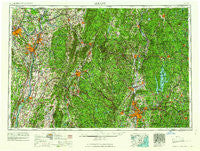
~ Albany NY topo map, 1:250000 scale, 1 X 2 Degree, Historical, 1962
Albany, New York, USGS topographic map dated 1962.
Includes geographic coordinates (latitude and longitude). This topographic map is suitable for hiking, camping, and exploring, or framing it as a wall map.
Printed on-demand using high resolution imagery, on heavy weight and acid free paper, or alternatively on a variety of synthetic materials.
Topos available on paper, Waterproof, Poly, or Tyvek. Usually shipping rolled, unless combined with other folded maps in one order.
- Product Number: USGS-5454807
- Free digital map download (high-resolution, GeoPDF): Albany, New York (file size: 20 MB)
- Map Size: please refer to the dimensions of the GeoPDF map above
- Weight (paper map): ca. 55 grams
- Map Type: POD USGS Topographic Map
- Map Series: HTMC
- Map Verison: Historical
- Cell ID: 68639
- Scan ID: 136554
- Woodland Tint: Yes
- Visual Version Number: 1
- Field Check Year: 1956
- Datum: Unstated
- Map Projection: Transverse Mercator
- Map published by United States Army
- Map Language: English
- Scanner Resolution: 600 dpi
- Map Cell Name: Albany
- Grid size: 1 X 2 Degree
- Date on map: 1962
- Map Scale: 1:250000
- Geographical region: New York, United States
Neighboring Maps:
All neighboring USGS topo maps are available for sale online at a variety of scales.
Spatial coverage:
Topo map Albany, New York, covers the geographical area associated the following places:
- The Boulders - Three Rivers - Hampton Manor - West Royalston - High Falls - Littleville - Center Cambridge - Mount Marion Park - Ashley Falls - Newtown - Hamburg - East Swanzey - Fox Wander West - Indian Lake Estates - Willow Brook Park - Savoy Center - Sky Farm - Orange - Albia - Smithville - Schodack Center - Loudville - Annandale-on-Hudson - West Farms - Oak Hill Landing - McClaveville - Templeton - East Hadley - Camp Greylock - Tenneyville - Marlborough - South Cairo - Conway - Goss Heights - West Camp - Alford - Brooks Village - Whitney Estates - Sandisfield - East Dummerston - Meadowbrook Green - North Vernon - Brightwood - Dell - Boyntonville - Potter Hill - Mountain View - Richmond Furnace - Jones Corner - Poocham - Congamond - Clinton Heights - Beukendaal - Camp Notre Dame - White Creek - Camp Wyoma - Niverville - Upper Hollowville - North Schodack - Limestreet - Katsbaan - Sodom - Latham Mobile Home Court - Copake - Montague City - Buckland - Wilbraham - Parkers Corners - Crane Lake Camp - Robinson Crusoe Camp - Kerleys Corners - Morse Village - Fitzwilliam Depot - Roberts Hill - Bassets Corner - Wackmans Mobile Home Park - Clifton Park Center - Whitehouse Crossing - East Hillsdale - West Lebanon - Raymertown - Hallum Trailer Park - Green River - Coeymans Hollow - Springfield Hill - North Germantown - Cooks Corner - Denault Corners - Sheffield - Hinsdale - Muitzes Kill - Fomer - Bondsville - Rexford - Dutch Village Mobile Home Park - West Farms - South Wendell - Pine Haven Motor Home Park - Nassau - New Lenox
- Map Area ID: AREA4342-74-72
- Northwest corner Lat/Long code: USGSNW43-74
- Northeast corner Lat/Long code: USGSNE43-72
- Southwest corner Lat/Long code: USGSSW42-74
- Southeast corner Lat/Long code: USGSSE42-72
- Northern map edge Latitude: 43
- Southern map edge Latitude: 42
- Western map edge Longitude: -74
- Eastern map edge Longitude: -72


