
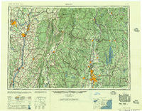
~ Albany NY topo map, 1:250000 scale, 1 X 2 Degree, Historical, 1957
Albany, New York, USGS topographic map dated 1957.
Includes geographic coordinates (latitude and longitude). This topographic map is suitable for hiking, camping, and exploring, or framing it as a wall map.
Printed on-demand using high resolution imagery, on heavy weight and acid free paper, or alternatively on a variety of synthetic materials.
Topos available on paper, Waterproof, Poly, or Tyvek. Usually shipping rolled, unless combined with other folded maps in one order.
- Product Number: USGS-5454801
- Free digital map download (high-resolution, GeoPDF): Albany, New York (file size: 21 MB)
- Map Size: please refer to the dimensions of the GeoPDF map above
- Weight (paper map): ca. 55 grams
- Map Type: POD USGS Topographic Map
- Map Series: HTMC
- Map Verison: Historical
- Cell ID: 68639
- Scan ID: 136544
- Woodland Tint: Yes
- Visual Version Number: 1
- Aerial Photo Year: 1945
- Datum: NAD27
- Map Projection: Transverse Mercator
- Map published by United States Army
- Map Language: English
- Scanner Resolution: 600 dpi
- Map Cell Name: Albany
- Grid size: 1 X 2 Degree
- Date on map: 1957
- Map Scale: 1:250000
- Geographical region: New York, United States
Neighboring Maps:
All neighboring USGS topo maps are available for sale online at a variety of scales.
Spatial coverage:
Topo map Albany, New York, covers the geographical area associated the following places:
- Woodford - Aqueduct - Elnora - State Line - South Athol - Babcock Lake - Drury - Stony Point - Knights Corner - Otis - Winchendon Center - South Sandisfield - Rosecrans Park - West Summit - Couse - Dormansville - Bassets Corner - Spaulding Furnace - McKnight and Bay - Loudonville - Verdoy - Mayo Corners - New Scotland - Sycaway - Rayville - Covered Wagon Court - North Otis - Hamburg - Wyben - Norwich Bridge - Plainville (historical) - Stillham - Tenneyville - Moorhouse Corner - Sturbridge - Round Lake - Camp Ashmere - Mount Marion Park - Grove - West Rindge - Bisbee Mill - East Sheffield - Amherst Center - Indian Lake Estates - Mill River - Lone Pine Community Mobile Home Park - Blandford - Austerlitz - Pratt Corner - West Pittsfield - Sodom - Glenridge - Cushman - Green River - Parkers Station - West Cambridge - South End - Boston Corner - East Buskirk - Hannacroix - Mundale - Loudon Heights - Sunnyside - Fruitwood Acres - Weatogue - Dana Center - Fort Lucas - Cozy Meadow Mobile Home Park - Stewartville - Golden Acres - Hillsdale - Omi - Barre Plains - Swanzey Station - East Grafton - Jonesville - Mahkeenac Shores - Brookfield Mobile Home Park - East Poestenkill - Goulding Village - Paucatuck (historical) - East Windsor - West Hartland - Glendale - Stoodley Corners - Amherst - John S Moore Homes - Camp Romaca - West Brookfield - Crescent Grove (historical) - Jacksonville - Butlerville - Steinmetz Homes - Cherry Hill - Camp Merrill - Garfield - Mellenville - Readsboro Falls - Normansville - West Swanzey
- Map Area ID: AREA4342-74-72
- Northwest corner Lat/Long code: USGSNW43-74
- Northeast corner Lat/Long code: USGSNE43-72
- Southwest corner Lat/Long code: USGSSW42-74
- Southeast corner Lat/Long code: USGSSE42-72
- Northern map edge Latitude: 43
- Southern map edge Latitude: 42
- Western map edge Longitude: -74
- Eastern map edge Longitude: -72


