
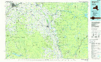
~ Watertown NY topo map, 1:100000 scale, 30 X 60 Minute, Historical, 1985, updated 1986
Watertown, New York, USGS topographic map dated 1985.
Includes geographic coordinates (latitude and longitude). This topographic map is suitable for hiking, camping, and exploring, or framing it as a wall map.
Printed on-demand using high resolution imagery, on heavy weight and acid free paper, or alternatively on a variety of synthetic materials.
Topos available on paper, Waterproof, Poly, or Tyvek. Usually shipping rolled, unless combined with other folded maps in one order.
- Product Number: USGS-5454771
- Free digital map download (high-resolution, GeoPDF): Watertown, New York (file size: 17 MB)
- Map Size: please refer to the dimensions of the GeoPDF map above
- Weight (paper map): ca. 55 grams
- Map Type: POD USGS Topographic Map
- Map Series: HTMC
- Map Verison: Historical
- Cell ID: 68552
- Scan ID: 136992
- Imprint Year: 1986
- Woodland Tint: Yes
- Visual Version Number: 1
- Aerial Photo Year: 1980
- Edit Year: 1985
- Datum: NAD27
- Map Projection: Universal Transverse Mercator
- Planimetric: Yes
- Map published by United States Geological Survey
- Map Language: English
- Scanner Resolution: 600 dpi
- Map Cell Name: Watertown
- Grid size: 30 X 60 Minute
- Date on map: 1985
- Map Scale: 1:100000
- Geographical region: New York, United States
Neighboring Maps:
All neighboring USGS topo maps are available for sale online at a variety of scales.
Spatial coverage:
Topo map Watertown, New York, covers the geographical area associated the following places:
- New Boston - Champion - Floral Estates Mobile Home Park - Soft Maple - West Martinsburg - East Rodman - Tylersville - Mohawk Hill - New Campbellwood Wye - Kosterville - Indian River - Welch Hill - Woodgate - Castorland - Barnes Corners - Glendale - Port Leyden - Watertown Center - High Falls - Lowville - Maple Lane Mobile Home Park - Michigan Mills - Constableville - Chateaugay - Greenboro - Glenfield - Otter Lake - Scotch Pine Manor Mobile Home Park - Smartville - Plantz Corners - Greig - Beaver Falls - Rices - Wolf Lake Landing - Garland City Trailer Park - Northland Estates Mobile Home Park - Evergreen Mobile Home Park - Rodman - Harrisburg - Otter Creek - Stillwater - Deer River - Lyonsdale - Number Four - Worth Center - West Lowville - Beecherville - Croghan - Rector - Huntingtonville - Fields Settlement - East Martinsburg - Zoar - East Watertown - New Bremen - Locust Grove - Hemlock District - Osceola - Minnehaha - Fowlersville - Naumburg - Otto Mills - Talcottville - Goulds Mill - West Carthage - Pine Meadows Mobile Home Park - Martinsburg - Old Campbellwood Wye - Sperryville - Waterville - Denmark - Hooker - Wetmore - Vorea - Collinsville - Rutland Center - Pekin - Crystal Dale - Thendara - Burrs Mills - Briggs Corner - Dadville - Clark Corners - Lyons Falls - Bellwood - East Boylston - Copenhagen - Honeyville - Boylston Center - Forest City - Hoseville - Pine Grove - New Scriba - Fish Creek - Winona - Carthage - Turin - Worth - North Osceola - Bushes Landing
- Map Area ID: AREA4443.5-76-75
- Northwest corner Lat/Long code: USGSNW44-76
- Northeast corner Lat/Long code: USGSNE44-75
- Southwest corner Lat/Long code: USGSSW43.5-76
- Southeast corner Lat/Long code: USGSSE43.5-75
- Northern map edge Latitude: 44
- Southern map edge Latitude: 43.5
- Western map edge Longitude: -76
- Eastern map edge Longitude: -75


