
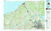
~ Syracuse NY topo map, 1:100000 scale, 30 X 60 Minute, Historical, 1985, updated 1994
Syracuse, New York, USGS topographic map dated 1985.
Includes geographic coordinates (latitude and longitude). This topographic map is suitable for hiking, camping, and exploring, or framing it as a wall map.
Printed on-demand using high resolution imagery, on heavy weight and acid free paper, or alternatively on a variety of synthetic materials.
Topos available on paper, Waterproof, Poly, or Tyvek. Usually shipping rolled, unless combined with other folded maps in one order.
- Product Number: USGS-5454751
- Free digital map download (high-resolution, GeoPDF): Syracuse, New York (file size: 25 MB)
- Map Size: please refer to the dimensions of the GeoPDF map above
- Weight (paper map): ca. 55 grams
- Map Type: POD USGS Topographic Map
- Map Series: HTMC
- Map Verison: Historical
- Cell ID: 68433
- Scan ID: 136944
- Imprint Year: 1994
- Woodland Tint: Yes
- Aerial Photo Year: 1980
- Edit Year: 1985
- Datum: NAD27
- Map Projection: Universal Transverse Mercator
- Map published by United States Geological Survey
- Map Language: English
- Scanner Resolution: 600 dpi
- Map Cell Name: Syracuse
- Grid size: 30 X 60 Minute
- Date on map: 1985
- Map Scale: 1:100000
- Geographical region: New York, United States
Neighboring Maps:
All neighboring USGS topo maps are available for sale online at a variety of scales.
Spatial coverage:
Topo map Syracuse, New York, covers the geographical area associated the following places:
- Lyndon Lawns Mobile Home Park - Ionia - Roosevelt Corners - Brewerton - Centerport - Bowens Corners - Oswego - Lysander - Kenyon Landing Mobile Home Park - Rice Mill - Riverview Mobile Court - Arthur - West Monroe - Baird Corners - Bethel Corners - Graftons Square - Orchard Mobile Home Park - Fruit Valley - Pember Corners - Maiden Lane Mobile Home Park - Lindbergh Lawns - Stewart Corners - York - Caughdenoy - Waterview Mobile Home Park - Wolcott - Kraus Landing - Hilltop Trailer Park - Little France - Lakeside - Syracuse - Malcon - East Bay Park - Martville - Hannibal - Pennellville - South Hannibal - West Genesee Terrace - East Syracuse - Sterling Valley - Indian Hills Mobile Home Park - Crestview Mobile Home Park - Fort Hill - Memphis - Alloway - Union Settlement - North Scriba - Valentines Beach - Cicero - Floridaville - Pitcher Hill - Parson Farms - Fairmount - Prattham - Hannibal Hills Mobile Home Park - Orchard Village - New Haven - Hillside Mobile Home Park - Sterling - Conifer Mobile Home Park - Fulton - Grant's Vacation Park Recreational Vehicle and Mobile Home Park - Fernwood - Hastings Center - Amboy - Woodard - Loomis Corner - Crocketts - Loomis Hill - Westview Manor - Woodland Manor Mobile Home Park - Martisco - Evans Corner - Westvale - Spring Lake - Wayne Center - Michael O'Brian's Mobile Home Park - Lake Bluff - Seneca Knolls - Lyons - Fox Meadow Mobile Home Park - Noble Corner - Collamer - Silver Rock Mobile Home Park - North Syracuse - Liverpool - Moyers Corners - Cicero Center - Clyde - Pleasant View - Idle Wheels Mobile Home Park - Sweets Crossing - Volney - Fawn Estates Mobile Home Park - East Palermo - Oot Park - Vermilion - Ingalls Crossing - Hinmansville - Edgewood Garden
- Map Area ID: AREA43.543-77-76
- Northwest corner Lat/Long code: USGSNW43.5-77
- Northeast corner Lat/Long code: USGSNE43.5-76
- Southwest corner Lat/Long code: USGSSW43-77
- Southeast corner Lat/Long code: USGSSE43-76
- Northern map edge Latitude: 43.5
- Southern map edge Latitude: 43
- Western map edge Longitude: -77
- Eastern map edge Longitude: -76


