
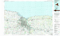
~ Rochester NY topo map, 1:100000 scale, 30 X 60 Minute, Historical, 1984, updated 1984
Rochester, New York, USGS topographic map dated 1984.
Includes geographic coordinates (latitude and longitude). This topographic map is suitable for hiking, camping, and exploring, or framing it as a wall map.
Printed on-demand using high resolution imagery, on heavy weight and acid free paper, or alternatively on a variety of synthetic materials.
Topos available on paper, Waterproof, Poly, or Tyvek. Usually shipping rolled, unless combined with other folded maps in one order.
- Product Number: USGS-5454743
- Free digital map download (high-resolution, GeoPDF): Rochester, New York (file size: 20 MB)
- Map Size: please refer to the dimensions of the GeoPDF map above
- Weight (paper map): ca. 55 grams
- Map Type: POD USGS Topographic Map
- Map Series: HTMC
- Map Verison: Historical
- Cell ID: 68246
- Scan ID: 136519
- Imprint Year: 1984
- Woodland Tint: Yes
- Aerial Photo Year: 1981
- Edit Year: 1984
- Datum: NAD27
- Map Projection: Universal Transverse Mercator
- Planimetric: Yes
- Map published by United States Geological Survey
- Map Language: English
- Scanner Resolution: 600 dpi
- Map Cell Name: Rochester
- Grid size: 30 X 60 Minute
- Date on map: 1984
- Map Scale: 1:100000
- Geographical region: New York, United States
Neighboring Maps:
All neighboring USGS topo maps are available for sale online at a variety of scales.
Spatial coverage:
Topo map Rochester, New York, covers the geographical area associated the following places:
- Hinkleyville - Hannans Corner - Sweden Center - Marbletown - Forest Lawn - Adams Basin - Belcoda - Sunset Valley Manufactured Home Community - Idlewood On The Lake - Lincoln - Chili Center - Hilton - Owls Nest - Shore Acres - Thorntons Corner - Otis - Cobbs Hill - Grand View Heights - Windsor Beach - Island Cottage Beach - Trolley Bed Road Park - Bailey - Barnard - Brownsville - Garland - Hidden Meadows - September Place Mobile Home Park - Ontario on the Lake - Braddock Heights - Gates Center - Sodus Mobile Home Park - Newark - White City - Bay View - North Le Roxy - Huddle - Oklahoma Beach - Clarkson Mobile Home Park - Uptonville - West Sweden - Martin - Fort Hill - Hamlin - Rochester - Hillcrest Trailer Court - Otis - Brookdale - Ontario Beach - Irondequoit - Elmgrove - Clarkson - Scottsville - Lincoln Park - Stone Church - Valley View Mobile Home Park - Port Gibson - West Walworth - Macedon - Twelve Corners - Cooney Crossing - Grand View Beach - Lighthouse Beach - Bartlett Corners - Crescent Beach - Rock Beach - Clifton - Joy - West Chili - Brockport - Wheatland Center - Lime Kiln - Collamer - Manitou Beach - Ontario Center - Davison Beach - Hidden Valley Mobile Home Park - Galvins Mobile Home Park - Arrowhead Mobile Home Park - German Village - Vienna Estates - Harper Park - Mount Read - East Penfield - Crittenden - Parma Corners - Cedar Swamp - Greece - Farmington - Whipple Park - Morton - Parma Center - Egypt - Williamson - Tressmar - Hydesville - West Greece - Wallington - Benedict Beach - Sea Breeze - Brighton
- Map Area ID: AREA43.543-78-77
- Northwest corner Lat/Long code: USGSNW43.5-78
- Northeast corner Lat/Long code: USGSNE43.5-77
- Southwest corner Lat/Long code: USGSSW43-78
- Southeast corner Lat/Long code: USGSSE43-77
- Northern map edge Latitude: 43.5
- Southern map edge Latitude: 43
- Western map edge Longitude: -78
- Eastern map edge Longitude: -77


