
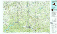
~ Olean NY topo map, 1:100000 scale, 30 X 60 Minute, Historical, 1986, updated 1994
Olean, New York, USGS topographic map dated 1986.
Includes geographic coordinates (latitude and longitude). This topographic map is suitable for hiking, camping, and exploring, or framing it as a wall map.
Printed on-demand using high resolution imagery, on heavy weight and acid free paper, or alternatively on a variety of synthetic materials.
Topos available on paper, Waterproof, Poly, or Tyvek. Usually shipping rolled, unless combined with other folded maps in one order.
- Product Number: USGS-5454729
- Free digital map download (high-resolution, GeoPDF): Olean, New York (file size: 25 MB)
- Map Size: please refer to the dimensions of the GeoPDF map above
- Weight (paper map): ca. 55 grams
- Map Type: POD USGS Topographic Map
- Map Series: HTMC
- Map Verison: Historical
- Cell ID: 68088
- Scan ID: 137483
- Imprint Year: 1994
- Woodland Tint: Yes
- Aerial Photo Year: 1981
- Edit Year: 1986
- Datum: NAD27
- Map Projection: Universal Transverse Mercator
- Map published by United States Geological Survey
- Map Language: English
- Scanner Resolution: 600 dpi
- Map Cell Name: Olean
- Grid size: 30 X 60 Minute
- Date on map: 1986
- Map Scale: 1:100000
- Geographical region: New York, United States
Neighboring Maps:
All neighboring USGS topo maps are available for sale online at a variety of scales.
Spatial coverage:
Topo map Olean, New York, covers the geographical area associated the following places:
- Randolph - Peth - Bellville - Rawson - Bradford Junction - Sawyer - Maplehurst - Ashford Hollow - Freedom Mobile Home Park - Devereaux - Alma - Red House - Homer Hill - Willoughby - Underwood Corner - McGrawville - Seneca Heights - Rock City - Abbotts - Vandalia - Oramel - Lake View Terrace - Plato - Napoli - Main Settlement - Fox - West Clarksville - Delevan - Bedford Corners - Collins Center - North Cuba - Centerville - Inavale - Aristotle - South Cuba - East Randolph - Gowanda - East Otto - Bowler - Freedom - Westons Mills - Riceville - Village of Saint Anthony - Sawyer Trailer Court - Chipmunk - Rushford - Zoar - Wirt - Knapp Creek - Farmersville - Eddyville - Lyons Corners - Hinsdale - Laidlaw - Little Valley - West Valley - Haydenville - Houghton - Whiteford Hollow - Toll Gate Corner - Woodhill Estates Mobile Home Park - Allegany - Brooklyn - Olean - Crestview - Humphrey - Persia - South Bolivar - Orlando - Cuba - Black Creek - Snyders Corners - Higgins - Jolee Mobile Home Community - Allentown - Humphrey Center - Haskell Flats - Ishua Valley Estates Mobile Home Park - New Albion - Five Points - South Carrollton - Little Genesee - Salamanca - Lyndon - Maple Grove Mobile Home Estates - Belvidere - Otto - Kill Buck - Hume - Hardy Corners - West Notch - Steamburg - Machias - Belmont - Sandusky - Wesley - Shongo - Carroll - Machias Junction - Hillcrest
- Map Area ID: AREA42.542-79-78
- Northwest corner Lat/Long code: USGSNW42.5-79
- Northeast corner Lat/Long code: USGSNE42.5-78
- Southwest corner Lat/Long code: USGSSW42-79
- Southeast corner Lat/Long code: USGSSE42-78
- Northern map edge Latitude: 42.5
- Southern map edge Latitude: 42
- Western map edge Longitude: -79
- Eastern map edge Longitude: -78


