
~ Lockport NY topo map, 1:100000 scale, 30 X 60 Minute, Historical, 1984, updated 1994
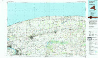
Lockport, New York, USGS topographic map dated 1984.
Includes geographic coordinates (latitude and longitude). This topographic map is suitable for hiking, camping, and exploring, or framing it as a wall map.
Printed on-demand using high resolution imagery, on heavy weight and acid free paper, or alternatively on a variety of synthetic materials.
Topos available on paper, Waterproof, Poly, or Tyvek. Usually shipping rolled, unless combined with other folded maps in one order.
- Product Number: USGS-5454691
- Free digital map download (high-resolution, GeoPDF): Lockport, New York (file size: 20 MB)
- Map Size: please refer to the dimensions of the GeoPDF map above
- Weight (paper map): ca. 55 grams
- Map Type: POD USGS Topographic Map
- Map Series: HTMC
- Map Verison: Historical
- Cell ID: 67861
- Scan ID: 137372
- Imprint Year: 1994
- Woodland Tint: Yes
- Visual Version Number: 1
- Aerial Photo Year: 1978
- Edit Year: 1984
- Datum: NAD27
- Map Projection: Universal Transverse Mercator
- Map published by United States Geological Survey
- Map Language: English
- Scanner Resolution: 600 dpi
- Map Cell Name: Lockport
- Grid size: 30 X 60 Minute
- Date on map: 1984
- Map Scale: 1:100000
- Geographical region: New York, United States
Neighboring Maps:
All neighboring USGS topo maps are available for sale online at a variety of scales.
Spatial coverage:
Topo map Lockport, New York, covers the geographical area associated the following places:
- Hinsburg - North Ridge - Colonial Village - Byron - Wheatville - Rainbow Mobile Home Park - County Line Mobile Home Park - Hulberton - Waterport Station - Tonawanda - Dreamland Mobile Home Park - Five Corners - Fancher - Warrens Corners - Rapids Mobile Home Park - North Forest Acres - Akron Junction - East Clarence - Elberta - East Amherst - Cookville - Jones Beach - Five Corners - Somerset - Knowlesville - Newfane - Platten - Applewood Mobile Home Estates - Thomas Estates West - Akron - Glenwood - Gaines Basin - East Elba - Walmore - Ridgewood Village - Shooktown - Gilberts Corner - Rapids - Kuckville - Millers - Langton Corners - Dysinger - Streeters Corners - Nottingham Estates - Westside Mobile Home Park - Sandy Beach - South Lockport - Cayuga Village Mobile Home Park - Green Acres Valley - Point Breeze - Raymond - Hess Road - Uneeda Beach - Shelby Basin - Ridgewood - South Barre - Baldwin Corner - La Salle - North Ridgeway - County Line - Comstock Corners - Johnson Creek - Wurlitzer Park Village - Clarence Center - West Barre - Lake Breeze Mobile Home Park - Bergholtz - Ridgeview Homes Mobile Home Park - Corwin - Heritage Estates - South Wilson - Lyndonville - Sunset Beach - Manning - Richs Corners - Millville - West Gaines - Five Corners - Suburban Acres Mobile Home Park - Old Mill Mobile Home Park - Orangeport - Brockville - McNalls - Shelby Center - Millersport - West Kendall - Sunset Beach - Love Canal - Medina - Batavia Downs Trailer Park - Carlisle Gardens - East Barre - North Tonawanda - Edgewater - Alabama - Swormville - East Shelby - Olcott - Porter Center - Lomond Shore
- Map Area ID: AREA43.543-79-78
- Northwest corner Lat/Long code: USGSNW43.5-79
- Northeast corner Lat/Long code: USGSNE43.5-78
- Southwest corner Lat/Long code: USGSSW43-79
- Southeast corner Lat/Long code: USGSSE43-78
- Northern map edge Latitude: 43.5
- Southern map edge Latitude: 43
- Western map edge Longitude: -79
- Eastern map edge Longitude: -78


