
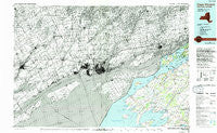
~ Cape Vincent NY topo map, 1:100000 scale, 30 X 60 Minute, Historical, 1985, updated 1994
Cape Vincent, New York, USGS topographic map dated 1985.
Includes geographic coordinates (latitude and longitude). This topographic map is suitable for hiking, camping, and exploring, or framing it as a wall map.
Printed on-demand using high resolution imagery, on heavy weight and acid free paper, or alternatively on a variety of synthetic materials.
Topos available on paper, Waterproof, Poly, or Tyvek. Usually shipping rolled, unless combined with other folded maps in one order.
- Product Number: USGS-5454655
- Free digital map download (high-resolution, GeoPDF): Cape Vincent, New York (file size: 26 MB)
- Map Size: please refer to the dimensions of the GeoPDF map above
- Weight (paper map): ca. 55 grams
- Map Type: POD USGS Topographic Map
- Map Series: HTMC
- Map Verison: Historical
- Cell ID: 72627
- Scan ID: 137154
- Imprint Year: 1994
- Woodland Tint: Yes
- Visual Version Number: 1
- Photo Inspection Year: 1989
- Aerial Photo Year: 1980
- Edit Year: 1985
- Datum: NAD27
- Map Projection: Universal Transverse Mercator
- Map published by United States Geological Survey
- Map Language: English
- Scanner Resolution: 600 dpi
- Map Cell Name: Cape Vincent
- Grid size: 30 X 60 Minute
- Date on map: 1985
- Map Scale: 1:100000
- Geographical region: New York, United States
Neighboring Maps:
All neighboring USGS topo maps are available for sale online at a variety of scales.
Spatial coverage:
Topo map Cape Vincent, New York, covers the geographical area associated the following places:
- Lazy Acres Mobile Home Park - Point Peninsula - Saint Lawrence - Herrick Grove - Perch River - Reynolds Corner - Clayton - Depauville - Thousand Island Park - Clayton Center - Fishers Landing - Adams Cove - Millen Bay - Frontenac - Chaumont - Dexter - Rosiere - Upper Town Landing - Lawrence View Mobile Home Park - Shady Bay Mobile Home Park - Sunset Trailer Park - Grindstone - Lower Town Landing - Fineview - Cape Vincent - Bayview - Sunnybank - Green Cedars Trailer Park - Grenell - Breezy Knoll Mobile Home Park - Warren - Three Mile Bay - Limerick - Le Petite Ciel Mobile Home Park - Grandview Park - Rainbow Shores Mobile Home Park
- Map Area ID: AREA44.544-77-76
- Northwest corner Lat/Long code: USGSNW44.5-77
- Northeast corner Lat/Long code: USGSNE44.5-76
- Southwest corner Lat/Long code: USGSSW44-77
- Southeast corner Lat/Long code: USGSSE44-76
- Northern map edge Latitude: 44.5
- Southern map edge Latitude: 44
- Western map edge Longitude: -77
- Eastern map edge Longitude: -76


