
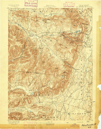
~ Kaaterskill NY topo map, 1:62500 scale, 15 X 15 Minute, Historical, 1893
Kaaterskill, New York, USGS topographic map dated 1893.
Includes geographic coordinates (latitude and longitude). This topographic map is suitable for hiking, camping, and exploring, or framing it as a wall map.
Printed on-demand using high resolution imagery, on heavy weight and acid free paper, or alternatively on a variety of synthetic materials.
Topos available on paper, Waterproof, Poly, or Tyvek. Usually shipping rolled, unless combined with other folded maps in one order.
- Product Number: USGS-5452021
- Free digital map download (high-resolution, GeoPDF): Kaaterskill, New York (file size: 10 MB)
- Map Size: please refer to the dimensions of the GeoPDF map above
- Weight (paper map): ca. 55 grams
- Map Type: POD USGS Topographic Map
- Map Series: HTMC
- Map Verison: Historical
- Cell ID: 55942
- Scan ID: 139750
- Visual Version Number: 1
- Survey Year: 1892
- Datum: Unstated
- Map Projection: Unstated
- Map published by United States Geological Survey
- Map Language: English
- Scanner Resolution: 600 dpi
- Map Cell Name: Kaaterskill
- Grid size: 15 X 15 Minute
- Date on map: 1893
- Map Scale: 1:62500
- Geographical region: New York, United States
Neighboring Maps:
All neighboring USGS topo maps are available for sale online at a variety of scales.
Spatial coverage:
Topo map Kaaterskill, New York, covers the geographical area associated the following places:
- East Jewett - West Saugerties - Edgewood - Trinka's Mobile Home Park - Ruby - Shady - Zena - Ledgewood Park - Elka Park - Shultis Corners - Elliot Mobile Home Park - Onteora Park - Blue Mountain - Centerville - Haines Falls - Manorville - Twilight Park - Bearsville - Byrdcliffe - Willow - Daisy - Lake Hill - Woodstock - Platte Clove - Glenford - Tannersville - High Woods - Hunter - Fish Creek - Wittenberg - Montoma - Palenville
- Map Area ID: AREA42.2542-74.25-74
- Northwest corner Lat/Long code: USGSNW42.25-74.25
- Northeast corner Lat/Long code: USGSNE42.25-74
- Southwest corner Lat/Long code: USGSSW42-74.25
- Southeast corner Lat/Long code: USGSSE42-74
- Northern map edge Latitude: 42.25
- Southern map edge Latitude: 42
- Western map edge Longitude: -74.25
- Eastern map edge Longitude: -74


