
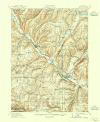
~ Bath NY topo map, 1:62500 scale, 15 X 15 Minute, Historical, 1910, updated 1944
Bath, New York, USGS topographic map dated 1910.
Includes geographic coordinates (latitude and longitude). This topographic map is suitable for hiking, camping, and exploring, or framing it as a wall map.
Printed on-demand using high resolution imagery, on heavy weight and acid free paper, or alternatively on a variety of synthetic materials.
Topos available on paper, Waterproof, Poly, or Tyvek. Usually shipping rolled, unless combined with other folded maps in one order.
- Product Number: USGS-5450599
- Free digital map download (high-resolution, GeoPDF): Bath, New York (file size: 9 MB)
- Map Size: please refer to the dimensions of the GeoPDF map above
- Weight (paper map): ca. 55 grams
- Map Type: POD USGS Topographic Map
- Map Series: HTMC
- Map Verison: Historical
- Cell ID: 51007
- Scan ID: 123202
- Imprint Year: 1944
- Survey Year: 1908
- Datum: NAD
- Map Projection: Polyconic
- Map published by United States Geological Survey
- Map Language: English
- Scanner Resolution: 600 dpi
- Map Cell Name: Bath
- Grid size: 15 X 15 Minute
- Date on map: 1910
- Map Scale: 1:62500
- Geographical region: New York, United States
Neighboring Maps:
All neighboring USGS topo maps are available for sale online at a variety of scales.
Spatial coverage:
Topo map Bath, New York, covers the geographical area associated the following places:
- East Union - Marshalls - Towlesville - Dineharts - Hermitage - Lake Country Estates Mobile Home Park - North Thurston - Stickneys - Buck Settlement - North Cameron - Renchans - Kanona - Old Field Mobile Home Park - Avoca - Coss Corners - Wheeler - Unionville - Pleasant Valley - Wallace - Mitchellsville - Dudley Settlement - Lake Country Estates - Bloomerville - Bonny Hill - The Homes Of Wildflower Hills - Bath - Rheims - Haverling Heights - Knight Settlement - J and M Green Acres Mobile Home Park - Cold Springs
- Map Area ID: AREA42.542.25-77.5-77.25
- Northwest corner Lat/Long code: USGSNW42.5-77.5
- Northeast corner Lat/Long code: USGSNE42.5-77.25
- Southwest corner Lat/Long code: USGSSW42.25-77.5
- Southeast corner Lat/Long code: USGSSE42.25-77.25
- Northern map edge Latitude: 42.5
- Southern map edge Latitude: 42.25
- Western map edge Longitude: -77.5
- Eastern map edge Longitude: -77.25


