
~ Pharaoh Mountain NY topo map, 1:24000 scale, 7.5 X 7.5 Minute, Historical, 1973, updated 1976
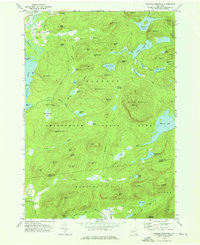
Pharaoh Mountain, New York, USGS topographic map dated 1973.
Includes geographic coordinates (latitude and longitude). This topographic map is suitable for hiking, camping, and exploring, or framing it as a wall map.
Printed on-demand using high resolution imagery, on heavy weight and acid free paper, or alternatively on a variety of synthetic materials.
Topos available on paper, Waterproof, Poly, or Tyvek. Usually shipping rolled, unless combined with other folded maps in one order.
- Product Number: USGS-5447782
- Free digital map download (high-resolution, GeoPDF): Pharaoh Mountain, New York (file size: 11 MB)
- Map Size: please refer to the dimensions of the GeoPDF map above
- Weight (paper map): ca. 55 grams
- Map Type: POD USGS Topographic Map
- Map Series: HTMC
- Map Verison: Historical
- Cell ID: 34933
- Scan ID: 128968
- Imprint Year: 1976
- Woodland Tint: Yes
- Visual Version Number: 1
- Aerial Photo Year: 1971
- Field Check Year: 1973
- Datum: NAD27
- Map Projection: Transverse Mercator
- Map published by United States Geological Survey
- Map Language: English
- Scanner Resolution: 600 dpi
- Map Cell Name: Pharaoh Mountain
- Grid size: 7.5 X 7.5 Minute
- Date on map: 1973
- Map Scale: 1:24000
- Geographical region: New York, United States
Neighboring Maps:
All neighboring USGS topo maps are available for sale online at a variety of scales.
Spatial coverage:
Topo map Pharaoh Mountain, New York, covers the geographical area associated the following places:
- Crab Pond - Alder Pond - Beaver Meadow Marsh - Franks Hill - Pharoah Lake Brook - Schroon Lake Airport - Number Six Hill - Horseshoe Pond - Spectacle Pond Trail - Crane Pond - Stevens Mountain - Number Eight Hill - Shanty Bottom Brook - Meadow Hill - Pharoah Mountain Trail - Alder Creek - Number Eight Mountain - Pine Hill - Antwine Hill - Chub Pond - Harrison Marsh - Oxshoe Pond - Burnt Hill - Wilson Hill - Desolate Hill - Glidden Marsh - Ragged Mountain - Pyramid Brook - Spectacle Pond - Sucker Hole Hill - Bear Mountain - Beaver Meadow Hill - Pharoah Lake - Wilson Brook - Third Brother - Coffee Pond - Pine Hill - Sugar Hill - Goose Pond Hill - Little Stevens - Meadow Cove - Steep Bay - Desolate Swamp - The Dam Hill - Carey Hill - Spectacle Pond Hill - Burge Pond - Platt Brook - Plank Bridge Hill - Orange Hill - Goose Pond - Desolate Brook - Lockwood Bay - Smith and Leland Hill - Rock Pond Brook - Steep Bay Hill - Pharaoh Mountain - Wilcox Pond - Gull Pond - Blue Hill - Whortleberry Pond - Number Seven Hill - Owls Head - Pyramid Lake - Crab Pond - Park Mountain - Long Swing Trail
- Map Area ID: AREA43.87543.75-73.75-73.625
- Northwest corner Lat/Long code: USGSNW43.875-73.75
- Northeast corner Lat/Long code: USGSNE43.875-73.625
- Southwest corner Lat/Long code: USGSSW43.75-73.75
- Southeast corner Lat/Long code: USGSSE43.75-73.625
- Northern map edge Latitude: 43.875
- Southern map edge Latitude: 43.75
- Western map edge Longitude: -73.75
- Eastern map edge Longitude: -73.625


