
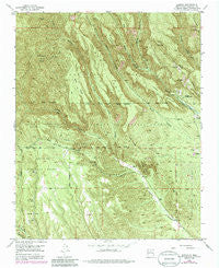
~ Canada NM topo map, 1:24000 scale, 7.5 X 7.5 Minute, Historical, 1953, updated 1985
Canada, New Mexico, USGS topographic map dated 1953.
Includes geographic coordinates (latitude and longitude). This topographic map is suitable for hiking, camping, and exploring, or framing it as a wall map.
Printed on-demand using high resolution imagery, on heavy weight and acid free paper, or alternatively on a variety of synthetic materials.
Topos available on paper, Waterproof, Poly, or Tyvek. Usually shipping rolled, unless combined with other folded maps in one order.
- Product Number: USGS-5378692
- Free digital map download (high-resolution, GeoPDF): Canada, New Mexico (file size: 19 MB)
- Map Size: please refer to the dimensions of the GeoPDF map above
- Weight (paper map): ca. 55 grams
- Map Type: POD USGS Topographic Map
- Map Series: HTMC
- Map Verison: Historical
- Cell ID: 6995
- Scan ID: 192402
- Imprint Year: 1985
- Woodland Tint: Yes
- Photo Revision Year: 1978
- Aerial Photo Year: 1975
- Edit Year: 1978
- Datum: NAD27
- Map Projection: Polyconic
- Map published by United States Geological Survey
- Map Language: English
- Scanner Resolution: 600 dpi
- Map Cell Name: Canada
- Grid size: 7.5 X 7.5 Minute
- Date on map: 1953
- Map Scale: 1:24000
- Geographical region: New Mexico, United States
Neighboring Maps:
All neighboring USGS topo maps are available for sale online at a variety of scales.
Spatial coverage:
Topo map Canada, New Mexico, covers the geographical area associated the following places:
- Puzzle Claim - Rising Sun Lode - Pumice Mines - Otto Pit - Copper Prospect - Corner Lode - Colle Canyon - No Name Lode - Albemarle - West Mesa - Horn Mesa - Rancho Cañada - Saint Peters Dome Trail - Toby Group - A B Group - Pumice Mine - T.S. Kline Lode - Midnight Lode - Group B Claims - Medio Dia Canyon - Gold Range Group - Union - La Jara Canyon - Santa Barbabra Group - Sun - Pumice Mine - Pumice Group Mine - Pumice Mine - Cerro Balitas - Corena Lode - Cañada - Albemarle Group - Albemarle Post Office (historical) - Bearhead Peak - Cone Ridge - Cañada de Cochiti Grant - Oaks Mesa - Smuggler Lode - Cerro Picacho - Benson Claim - Cañada Cabin - Tent Rocks - Ellen L Mine - Pumice Group Mine - Pumice Group Mine - Pumice Group Mine - Cañada Camada - Bear Jump - Victor Number Two - Monte Carlo Lode - Pumice Mine
- Map Area ID: AREA35.7535.625-106.5-106.375
- Northwest corner Lat/Long code: USGSNW35.75-106.5
- Northeast corner Lat/Long code: USGSNE35.75-106.375
- Southwest corner Lat/Long code: USGSSW35.625-106.5
- Southeast corner Lat/Long code: USGSSE35.625-106.375
- Northern map edge Latitude: 35.75
- Southern map edge Latitude: 35.625
- Western map edge Longitude: -106.5
- Eastern map edge Longitude: -106.375


