Canada, sleeved by National Geographic Maps
Click to Zoom (high resolution)
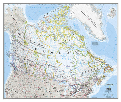
National Geographics map of Canada is one of the most authoritative maps of The Great White North. This Classic style wall map features a bright color palette with blue oceans and the countrys terrain detailed in stunning shaded relief that has been a hallmark of National Geographic maps for over 75 years. Thousands of place names, accurate political boundaries, national parks, and major infrastructure networks such as roads, canals, ferry routes, and railroads are detailed. Coastal bathymetry is shown with depth curves and soundings, and the boundaries of the winter extent of sea ice are marked as well. Coverage also includes Iceland, Greenland, and portions of the United States.
- Product Number: 2056442M
- Product Code: NG_CAN_WA_S
- Publisher Product ID: RE01020527
- ISBN: 9781597753531
- Year of Publication: 2011
- Unfolded Size: 28.74 x 34.84 inches
- Map type: Wall Map
- Geographical region: Canada