
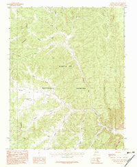
~ Canada Ojitos NM topo map, 1:24000 scale, 7.5 X 7.5 Minute, Historical, 1983, updated 1983
Canada Ojitos, New Mexico, USGS topographic map dated 1983.
Includes geographic coordinates (latitude and longitude). This topographic map is suitable for hiking, camping, and exploring, or framing it as a wall map.
Printed on-demand using high resolution imagery, on heavy weight and acid free paper, or alternatively on a variety of synthetic materials.
Topos available on paper, Waterproof, Poly, or Tyvek. Usually shipping rolled, unless combined with other folded maps in one order.
- Product Number: USGS-5378680
- Free digital map download (high-resolution, GeoPDF): Canada Ojitos, New Mexico (file size: 15 MB)
- Map Size: please refer to the dimensions of the GeoPDF map above
- Weight (paper map): ca. 55 grams
- Map Type: POD USGS Topographic Map
- Map Series: HTMC
- Map Verison: Historical
- Cell ID: 7001
- Scan ID: 189938
- Imprint Year: 1983
- Woodland Tint: Yes
- Aerial Photo Year: 1976
- Edit Year: 1983
- Field Check Year: 1978
- Datum: NAD27
- Map Projection: Transverse Mercator
- Provisional map: Yes
- Map published by United States Geological Survey
- Map Language: English
- Scanner Resolution: 600 dpi
- Map Cell Name: Canada Ojitos
- Grid size: 7.5 X 7.5 Minute
- Date on map: 1983
- Map Scale: 1:24000
- Geographical region: New Mexico, United States
Neighboring Maps:
All neighboring USGS topo maps are available for sale online at a variety of scales.
Spatial coverage:
Topo map Canada Ojitos, New Mexico, covers the geographical area associated the following places:
- Syphers Ranch - Wolf Draw - Boot Jack Canyon - Corral Tank - Corral Canyon - Laguna Simon - Largo Spring - Pasture Tank - Horse Heaven Canyon - Deer Run - Cañada Ojitos - Cañada Tanques - Cañada Gurule - Rodent Tank - Collins Ranch - Tanques Water Well - Laguna Seca - Young Prospect - Cañada Jose - Fence Tank - Spruce Canyon - Cañada Jesus Moya - Lang Canyon - Pasture Canyon - Nogales Cliff House - Bond Canyon - Cañada Simon
- Map Area ID: AREA36.536.375-107-106.875
- Northwest corner Lat/Long code: USGSNW36.5-107
- Northeast corner Lat/Long code: USGSNE36.5-106.875
- Southwest corner Lat/Long code: USGSSW36.375-107
- Southeast corner Lat/Long code: USGSSE36.375-106.875
- Northern map edge Latitude: 36.5
- Southern map edge Latitude: 36.375
- Western map edge Longitude: -107
- Eastern map edge Longitude: -106.875


