
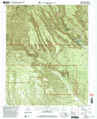
~ Canada NW NM topo map, 1:24000 scale, 7.5 X 7.5 Minute, Historical, 2002, updated 2003
Canada NW, New Mexico, USGS topographic map dated 2002.
Includes geographic coordinates (latitude and longitude). This topographic map is suitable for hiking, camping, and exploring, or framing it as a wall map.
Printed on-demand using high resolution imagery, on heavy weight and acid free paper, or alternatively on a variety of synthetic materials.
Topos available on paper, Waterproof, Poly, or Tyvek. Usually shipping rolled, unless combined with other folded maps in one order.
- Product Number: USGS-5378678
- Free digital map download (high-resolution, GeoPDF): Canada NW, New Mexico (file size: 20 MB)
- Map Size: please refer to the dimensions of the GeoPDF map above
- Weight (paper map): ca. 55 grams
- Map Type: POD USGS Topographic Map
- Map Series: HTMC
- Map Verison: Historical
- Cell ID: 6995
- Scan ID: 192406
- Imprint Year: 2003
- Woodland Tint: Yes
- Aerial Photo Year: 1996
- Edit Year: 2002
- Datum: NAD27
- Map Projection: Transverse Mercator
- Map published by United States Forest Service
- Map Language: English
- Scanner Resolution: 600 dpi
- Map Cell Name: Canada
- Grid size: 7.5 X 7.5 Minute
- Date on map: 2002
- Map Scale: 1:24000
- Geographical region: New Mexico, United States
Neighboring Maps:
All neighboring USGS topo maps are available for sale online at a variety of scales.
Spatial coverage:
Topo map Canada NW, New Mexico, covers the geographical area associated the following places:
- Saint Peters Dome Trail - Tent Rocks - Puzzle Claim - West Mesa - Monte Carlo Lode - Albemarle Post Office (historical) - Ellen L Mine - Pumice Group Mine - Cañada - Pumice Mine - Cerro Picacho - Sun - Pumice Mine - Cañada Cabin - La Jara Canyon - Cerro Balitas - Rancho Cañada - Pumice Mines - Pumice Group Mine - Toby Group - Smuggler Lode - Union - Pumice Mine - Bear Jump - Cañada Camada - Cone Ridge - Santa Barbabra Group - Medio Dia Canyon - Pumice Group Mine - Benson Claim - Corner Lode - T.S. Kline Lode - Copper Prospect - Horn Mesa - Victor Number Two - Rising Sun Lode - Midnight Lode - A B Group - Albemarle Group - Cañada de Cochiti Grant - No Name Lode - Pumice Group Mine - Gold Range Group - Albemarle - Oaks Mesa - Corena Lode - Colle Canyon - Group B Claims - Otto Pit - Bearhead Peak - Pumice Mine
- Map Area ID: AREA35.7535.625-106.5-106.375
- Northwest corner Lat/Long code: USGSNW35.75-106.5
- Northeast corner Lat/Long code: USGSNE35.75-106.375
- Southwest corner Lat/Long code: USGSSW35.625-106.5
- Southeast corner Lat/Long code: USGSSE35.625-106.375
- Northern map edge Latitude: 35.75
- Southern map edge Latitude: 35.625
- Western map edge Longitude: -106.5
- Eastern map edge Longitude: -106.375


