
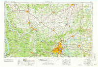
~ Nashville TN topo map, 1:250000 scale, 1 X 2 Degree, Historical, 1956, updated 1977
Nashville, Tennessee, USGS topographic map dated 1956.
Includes geographic coordinates (latitude and longitude). This topographic map is suitable for hiking, camping, and exploring, or framing it as a wall map.
Printed on-demand using high resolution imagery, on heavy weight and acid free paper, or alternatively on a variety of synthetic materials.
Topos available on paper, Waterproof, Poly, or Tyvek. Usually shipping rolled, unless combined with other folded maps in one order.
- Product Number: USGS-5339254
- Free digital map download (high-resolution, GeoPDF): Nashville, Tennessee (file size: 17 MB)
- Map Size: please refer to the dimensions of the GeoPDF map above
- Weight (paper map): ca. 55 grams
- Map Type: POD USGS Topographic Map
- Map Series: HTMC
- Map Verison: Historical
- Cell ID: 68928
- Scan ID: 149142
- Imprint Year: 1977
- Woodland Tint: Yes
- Aerial Photo Year: 1953
- Edit Year: 1969
- Field Check Year: 1956
- Datum: Unstated
- Map Projection: Transverse Mercator
- Map published by United States Geological Survey
- Map published by: Military, Other
- Map Language: English
- Scanner Resolution: 600 dpi
- Map Cell Name: Nashville
- Grid size: 1 X 2 Degree
- Date on map: 1956
- Map Scale: 1:250000
- Geographical region: Tennessee, United States
Neighboring Maps:
All neighboring USGS topo maps are available for sale online at a variety of scales.
Spatial coverage:
Topo map Nashville, Tennessee, covers the geographical area associated the following places:
- Port Royal - Hermitage Woods - Odum (historical) - Taylorsville - Hermon - Asbury - Mudtavern - Plant - Olmstead - Throckmorton - Rosebank - Blue Water Estates - Kinneys - Dog Town (historical) - Tennessee Ridge - Lake Spring (historical) - Prospect Hill (historical) - River Run - Sweet Home - Pleasant Grove - Sailors Rest (historical) - Cumberland Hills - Glenwood - Cumberland View - Barkwood - Vesta - Tuckers Crossroads - Providence - Cambridge Hills - Iroquois Estates - Charlestown Estates - Shady Grove - Hillcrest - Dover - Brentwood Estates - McKinnon - Yellow Creek - Bells Chapel (historical) - Meadorville - Cedar Grove (historical) - Hadensville - Pebble Creek - Tate (historical) - Washington Hall (historical) - Rival (historical) - Bon Air - Laguardo - Angeltown - Walnut Grove - Spring Creek (historical) - Germantown - Port Oliver Ford - Longwood - Keysburg - Weir (historical) - Johntown - Rockland - Wedgewood Estates - Colonial Court - Lakeside Park - Pegram - Greenbrier - Chestnut Grove - Three Forks - Pleasant Hill - Beverly - Red Top - Hayesville - Gold City - Hillview Estates - Nashboro Village - Green Acres - Jimtown (historical) - Morrow - Trigg Furnace - Reeders Crossing - Dannertown - Cumberland City - Pleasant Valley - Hardcastle - Flat Rock (historical) - Ashburn - Whiteoak Creek Subdivision - Liberty - Walnut Hills - In-A-Vale-Estates - Hunters Point - Townsend Grove (historical) - Buckner Pine Subdivision - Sulphura - Gravelotte - Adairville - Kepler - Butlers (historical) - Hickory Point - Haysville - Old Volney - Maple Grove - Neosheo - Jason Chapel
- Map Area ID: AREA3736-88-86
- Northwest corner Lat/Long code: USGSNW37-88
- Northeast corner Lat/Long code: USGSNE37-86
- Southwest corner Lat/Long code: USGSSW36-88
- Southeast corner Lat/Long code: USGSSE36-86
- Northern map edge Latitude: 37
- Southern map edge Latitude: 36
- Western map edge Longitude: -88
- Eastern map edge Longitude: -86


