
~ Memphis TN topo map, 1:250000 scale, 1 X 2 Degree, Historical, 1953, updated 1973
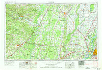
Memphis, Tennessee, USGS topographic map dated 1953.
Includes geographic coordinates (latitude and longitude). This topographic map is suitable for hiking, camping, and exploring, or framing it as a wall map.
Printed on-demand using high resolution imagery, on heavy weight and acid free paper, or alternatively on a variety of synthetic materials.
Topos available on paper, Waterproof, Poly, or Tyvek. Usually shipping rolled, unless combined with other folded maps in one order.
- Product Number: USGS-5339248
- Free digital map download (high-resolution, GeoPDF): Memphis, Tennessee (file size: 14 MB)
- Map Size: please refer to the dimensions of the GeoPDF map above
- Weight (paper map): ca. 55 grams
- Map Type: POD USGS Topographic Map
- Map Series: HTMC
- Map Verison: Historical
- Cell ID: 68906
- Scan ID: 150228
- Imprint Year: 1973
- Woodland Tint: Yes
- Edit Year: 1965
- Field Check Year: 1953
- Datum: Unstated
- Map Projection: Transverse Mercator
- Map published by United States Geological Survey
- Map published by United States Army Corps of Engineers
- Map published by United States Army
- Map Language: English
- Scanner Resolution: 600 dpi
- Map Cell Name: Memphis
- Grid size: 1 X 2 Degree
- Date on map: 1953
- Map Scale: 1:250000
- Geographical region: Tennessee, United States
Neighboring Maps:
All neighboring USGS topo maps are available for sale online at a variety of scales.
Spatial coverage:
Topo map Memphis, Tennessee, covers the geographical area associated the following places:
- Rosie - Cash - Gieseck - McJester - Arthur (historical) - Cord - Morton - Jennette - Herndon - Ramsey - Cunningham Corner - Joy - Jarta (historical) - Amith Addition - Johnstown - Norden - Floral - Almont (historical) - Judd Hill - Credit (historical) - Love Place - Donnick - Belcher - Topaz - Albion - Concord - Sedgwick - Merck (historical) - Sylvan Heights - Whistleville - Deep Landing - Carmi - Alicia - Aetna - Midway - White Chapel - Acklena - Nettleton - Pittinger - Apt - Dixie Homes - Strangers Home - Gammon - Penrose - Bassett - L'Anguille - Budsmith (historical) - Locke - Brown (historical) - Dunnington - Belknap (historical) - Corona - Ebony - Weona Junction - McClelland - Happy - Bay Village - Spriggs Mill - Pettyville - Claunch - Rosine - Jonquil - Pennington - Rosenbaum - Crawfordsville - Bengel - Clarks Corner - Poindexter - Tilton - Grand Glaise - Coldwater - Denmark - Mount Vernon (historical) - Princedale - Fourmile Hill - Doss (historical) - Plainview - Daggett - Madison - Morning Sun - Helfer Landing - Casey - Frayser - Edwards - Cypress (historical) - Hilton - Kinton - Pecan Point - Crow Creek - Center Hill - Big Lake - Dunn (historical) - Goodman - Midway Corner - Bothersome (historical) - Hopewell - Judsonia - Wranes (historical) - Stark City - Davis Spur
- Map Area ID: AREA3635-92-90
- Northwest corner Lat/Long code: USGSNW36-92
- Northeast corner Lat/Long code: USGSNE36-90
- Southwest corner Lat/Long code: USGSSW35-92
- Southeast corner Lat/Long code: USGSSE35-90
- Northern map edge Latitude: 36
- Southern map edge Latitude: 35
- Western map edge Longitude: -92
- Eastern map edge Longitude: -90


