
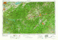
~ Knoxville TN topo map, 1:250000 scale, 1 X 2 Degree, Historical, 1957, updated 1966
Knoxville, Tennessee, USGS topographic map dated 1957.
Includes geographic coordinates (latitude and longitude). This topographic map is suitable for hiking, camping, and exploring, or framing it as a wall map.
Printed on-demand using high resolution imagery, on heavy weight and acid free paper, or alternatively on a variety of synthetic materials.
Topos available on paper, Waterproof, Poly, or Tyvek. Usually shipping rolled, unless combined with other folded maps in one order.
- Product Number: USGS-5339234
- Free digital map download (high-resolution, GeoPDF): Knoxville, Tennessee (file size: 22 MB)
- Map Size: please refer to the dimensions of the GeoPDF map above
- Weight (paper map): ca. 55 grams
- Map Type: POD USGS Topographic Map
- Map Series: HTMC
- Map Verison: Historical
- Cell ID: 68859
- Scan ID: 148016
- Imprint Year: 1966
- Woodland Tint: Yes
- Edit Year: 1966
- Field Check Year: 1957
- Datum: Unstated
- Map Projection: Transverse Mercator
- Map published by United States Army Corps of Engineers
- Map published by United States Army
- Map Language: English
- Scanner Resolution: 600 dpi
- Map Cell Name: Knoxville
- Grid size: 1 X 2 Degree
- Date on map: 1957
- Map Scale: 1:250000
- Geographical region: Tennessee, United States
Neighboring Maps:
All neighboring USGS topo maps are available for sale online at a variety of scales.
Spatial coverage:
Topo map Knoxville, Tennessee, covers the geographical area associated the following places:
- Ledger - Bent Tree - Cross Plains - Fingerville - Stony Fork - Swannanoa Hills - Little Chicago - Millican Grove - Higgins - Bear Wallow Hollow - Lake Rugby - West Marion - Riverside - Mount Zion - Middle Fork - Concord - Paint Fork - Toms Creek - Enka Village - Harrisburg - Indian Hills - Lee Walker Hots - Bills Creek - Candler - Laurel Park - Three Forks - Bryants Store (historical) - Mountain View - Five Points - Walkertown - Rattlesnake Lodge - Redmon - Cullowhee - Cinnimon Woods - Amerene (historical) - Sequoyah Woods - Glenville - Tremont - Big Pine - Pigeon Forge - Kodak - Tree Haven - Parkway Forest - Hawthorne - Indian Cove - Fox Ridge - Trundle Crossroad - Hayesville - Airport Plaza - Stone Creek - Birdsville (historical) - Mount View - Zion Grove - Springdale - Linwood Park - Fairview - Cane Brake - Rockford - Foster - Fairfield Mountains - Indian Lake Estates - Pinehurst - Fort Harry - Terry Creek - Riverside - Landrum - Beechwood - Double Island - Illahee Hills - Paint Rock - Sales Ford - Eastover - Hominy - Everett Heights - Shiloh - Westbridge - Big Laurel - Marietta - Midway - Quail Ridge - Tidmans Place - Hidetown - Essex - Montreat - Lumptown - Franklin Grove - Waverly - Bayview - Kanuga Ridge - Gneiss - Revilo (historical) - Mountain Lake Colony - Cedar Bluff - Farrport - Westwood Hills - Mack (historical) - New Hopewell - Tulula - Lawson Crossroad - Benton Hills
- Map Area ID: AREA3635-84-82
- Northwest corner Lat/Long code: USGSNW36-84
- Northeast corner Lat/Long code: USGSNE36-82
- Southwest corner Lat/Long code: USGSSW35-84
- Southeast corner Lat/Long code: USGSSE35-82
- Northern map edge Latitude: 36
- Southern map edge Latitude: 35
- Western map edge Longitude: -84
- Eastern map edge Longitude: -82


