
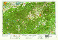
~ Knoxville TN topo map, 1:250000 scale, 1 X 2 Degree, Historical, 1960
Knoxville, Tennessee, USGS topographic map dated 1960.
Includes geographic coordinates (latitude and longitude). This topographic map is suitable for hiking, camping, and exploring, or framing it as a wall map.
Printed on-demand using high resolution imagery, on heavy weight and acid free paper, or alternatively on a variety of synthetic materials.
Topos available on paper, Waterproof, Poly, or Tyvek. Usually shipping rolled, unless combined with other folded maps in one order.
- Product Number: USGS-5339228
- Free digital map download (high-resolution, GeoPDF): Knoxville, Tennessee (file size: 22 MB)
- Map Size: please refer to the dimensions of the GeoPDF map above
- Weight (paper map): ca. 55 grams
- Map Type: POD USGS Topographic Map
- Map Series: HTMC
- Map Verison: Historical
- Cell ID: 68859
- Scan ID: 148013
- Woodland Tint: Yes
- Visual Version Number: 1
- Aerial Photo Year: 1951
- Datum: Unstated
- Map Projection: Transverse Mercator
- Map published by United States Army Corps of Engineers
- Map published by United States Army
- Map Language: English
- Scanner Resolution: 600 dpi
- Map Cell Name: Knoxville
- Grid size: 1 X 2 Degree
- Date on map: 1960
- Map Scale: 1:250000
- Geographical region: Tennessee, United States
Neighboring Maps:
All neighboring USGS topo maps are available for sale online at a variety of scales.
Spatial coverage:
Topo map Knoxville, Tennessee, covers the geographical area associated the following places:
- Williamsburg - Jonestown (historical) - Bryants Store (historical) - Cherokee Hills - Hatchertown - Rugby - Crooked Creek - Calvert - Terrace Gardens - Castle Heights - Chestnut Hill - Wildwood Heights - Mimosa Estates - Sixmile - Mills River - Iotla (historical) - Brickton - Stone Creek - Gapcreek (historical) - Five Oaks - Park Settlement - Rivertrace - Rock Springs - Lima - Moffitt Hill - Little River - Beverly Hills - Beaverdam - Cold Springs - Brookwood Trailer Park - Lake Santeetlah - Ridgeview Estates - Ola - Cosby - Butt Mountain - Wilham (historical) - U-No - Pleasant Gardens - Fontana Village - East Franklin - Pigeon Forge - West Haven - Stackhouse - Sweetgum - Asheville - Cross Plains - Rhodo - Sulphur Springs - Caesars Head - Oak Hill - Shaleville - College Park Estates - Grimesdale - Fines Creek - Upward - Loehencove Ridge - Rice Mill - Sequoyah Hills - Copper Ford - Cross William MHP - Beulah - Brookdale - Laurel Park Villas - Riverside Estates - Cowarts - Blackberry Inn - Highland Park - Murphy Junction - French Broad - London - The Pines - Springfield - Bessie - Blount Beach - Kona - Sevier Heights - Venable Community - Coburn - Kanuga Pines - Belmont Addition - De Hart Mill - Hot Springs - Middlebrook Heights - Deaver View - Arrwood Mill - Miller Cove - Lake Rugby - Mimosa Heights - Burnsville - Crestwood - Flat Rock Forest - Etowah - Knoxville - Oldham - Glade - Sky Village - Low Gap - Kanuga Park - Lake Junaluska - Skyland
- Map Area ID: AREA3635-84-82
- Northwest corner Lat/Long code: USGSNW36-84
- Northeast corner Lat/Long code: USGSNE36-82
- Southwest corner Lat/Long code: USGSSW35-84
- Southeast corner Lat/Long code: USGSSE35-82
- Northern map edge Latitude: 36
- Southern map edge Latitude: 35
- Western map edge Longitude: -84
- Eastern map edge Longitude: -82


