
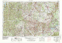
~ Columbia TN topo map, 1:250000 scale, 1 X 2 Degree, Historical, 1956, updated 1984
Columbia, Tennessee, USGS topographic map dated 1956.
Includes geographic coordinates (latitude and longitude). This topographic map is suitable for hiking, camping, and exploring, or framing it as a wall map.
Printed on-demand using high resolution imagery, on heavy weight and acid free paper, or alternatively on a variety of synthetic materials.
Topos available on paper, Waterproof, Poly, or Tyvek. Usually shipping rolled, unless combined with other folded maps in one order.
- Product Number: USGS-5339204
- Free digital map download (high-resolution, GeoPDF): Columbia, Tennessee (file size: 22 MB)
- Map Size: please refer to the dimensions of the GeoPDF map above
- Weight (paper map): ca. 55 grams
- Map Type: POD USGS Topographic Map
- Map Series: HTMC
- Map Verison: Historical
- Cell ID: 68726
- Scan ID: 149589
- Imprint Year: 1984
- Woodland Tint: Yes
- Visual Version Number: 1
- Photo Revision Year: 1978
- Aerial Photo Year: 1976
- Edit Year: 1978
- Field Check Year: 1956
- Datum: Unstated
- Map Projection: Transverse Mercator
- Map published by United States Geological Survey
- Map Language: English
- Scanner Resolution: 600 dpi
- Map Cell Name: Columbia
- Grid size: 1 X 2 Degree
- Date on map: 1956
- Map Scale: 1:250000
- Geographical region: Tennessee, United States
Neighboring Maps:
All neighboring USGS topo maps are available for sale online at a variety of scales.
Spatial coverage:
Topo map Columbia, Tennessee, covers the geographical area associated the following places:
- Turney - Lascassas Colonial Acres - Browns Mill - Coptown - Berrys Chapel - Idaho - Hickory Hills - Weakley - Glaze - Lanton - Pleasant Valley (historical) - Berea - Kissling Crossing - Little Ranch Acres - Lynnwood Downs - Circle J Park - Old Town (historical) - New Era (historical) - Fieldcrest - Curlee - Oakwood - Krapp Spring - Archer - Stella - Vernon - Palmer Heights - Oak Hill - Providence - Winstead (historical) - Hamilton Mill - Millview - Murfreesboro - Forest Hills - Seth - Crossroads - Gant - Harpeth - Satterfield (historical) - Coleman Heights - McCains - Concord - Fairview - Hill Estates - Penile Hill - Cotham (historical) - Mayberry Courts - Halls Hill - Liberty - Rich Creek - Rucker - Raysville - Leatherwood (historical) - Valley Green Estates - Greenwood - Southern Aire - Rebel Acres - Creekside - Greenhaw - Rodemer - Lodi - Capitol Hill - Buffalo - Teal (historical) - BAttlefield Meadows - Ovoca - New Antwerp (historical) - Rolling Rivers - Diana - Country Haven Estates - Keith Springs - Melrose Park - Littlelot - Valleyview - Burwood - Haynes Haven - Concord (historical) - Belleville - Cateston - Brenthaven North - Belle Mead - Fairview Heights - Elils Ranch Acres - Tottys Bend - Culpepper - Poplar Hill - Lickskillet (historical) - Vanntown - Gum Springs - Brenthaven East - Stonebrook - Hales Camp - Oak Grove - Royal Oaks - Bates - Metal Ford - Hurdlow - Royal Court - Lake Road - Theodore - Park Grove
- Map Area ID: AREA3635-88-86
- Northwest corner Lat/Long code: USGSNW36-88
- Northeast corner Lat/Long code: USGSNE36-86
- Southwest corner Lat/Long code: USGSSW35-88
- Southeast corner Lat/Long code: USGSSE35-86
- Northern map edge Latitude: 36
- Southern map edge Latitude: 35
- Western map edge Longitude: -88
- Eastern map edge Longitude: -86


