
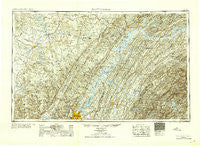
~ Chattanooga TN topo map, 1:250000 scale, 1 X 2 Degree, Historical, 1953
Chattanooga, Tennessee, USGS topographic map dated 1953.
Includes geographic coordinates (latitude and longitude). This topographic map is suitable for hiking, camping, and exploring, or framing it as a wall map.
Printed on-demand using high resolution imagery, on heavy weight and acid free paper, or alternatively on a variety of synthetic materials.
Topos available on paper, Waterproof, Poly, or Tyvek. Usually shipping rolled, unless combined with other folded maps in one order.
- Product Number: USGS-5339196
- Free digital map download (high-resolution, GeoPDF): Chattanooga, Tennessee (file size: 21 MB)
- Map Size: please refer to the dimensions of the GeoPDF map above
- Weight (paper map): ca. 55 grams
- Map Type: POD USGS Topographic Map
- Map Series: HTMC
- Map Verison: Historical
- Cell ID: 72221
- Scan ID: 148900
- Aerial Photo Year: 1944
- Datum: NAD27
- Map Projection: Transverse Mercator
- Map published by United States Army Corps of Engineers
- Map published by United States Army
- Map Language: English
- Scanner Resolution: 600 dpi
- Map Cell Name: Chattanooga
- Grid size: 1 X 2 Degree
- Date on map: 1953
- Map Scale: 1:250000
- Geographical region: Tennessee, United States
Neighboring Maps:
All neighboring USGS topo maps are available for sale online at a variety of scales.
Spatial coverage:
Topo map Chattanooga, Tennessee, covers the geographical area associated the following places:
- Forest Glen - Garden Farms - Mile Straight - Hope Acres - Sherwood - Orme - Echo Valley - Lakewood Village - Bear (historical) - Chestnut Valley - Pennine - Belk - Huckleberry - Boonville (historical) - Simpsons - White Hill - Bennett Acres - Greenwood - Dockery - Highland Homesite Addition - Woodmore - Chestnut Grove - Murphy - Tarlton - Conasauga - Timbercrest - Pine Grove - Bates Hill - Comfort - Tellico Plains - Sequoyah Estates - Tucker Springs - Curtistown - Landmark - Edgemont Forest - Newton - Fall City - Leoni - Friendsville - Ruby Falls - Byington - Regency Place - Wolf Creek - Shady Grove - Murray Store - Oxmore Hills - Edgewood Hills - Tellico Beach - Hanlan (historical) - Little Emory - Martel Estates - Wood Creek West - Edwards Point - Louisville - Green Hill - Marble Hill - Oak Hill North - Findlay - Jan Mor Acres - Morrison Springs - Gudger - Birnam Wood - Williamsburg Estates - Rabbit Bluff (historical) - Collins - Austin Farm - Beersheba Springs - Bent Tree - Sampson - Tantallon - Gruetli-Laager - Kimsey - Ridgewood - Sweetwater - Westlyn - South Pittsburg - Boxwood Hills - Hutsell - Homestead Acres - Center Hill - Stringtown - Jacen Gorbett Subdivision - Hothouse - Shelton Estates - Pine Harbor Heights - Post Oak Farms - Tranquillity - Harbor Heights - Reid Camp - Lake Dweller - Youngblood (historical) - Pine Hill - Ten Mile - Fox Den - Jeffrey (historical) - Centertown - Walling - Foxfire - Union Grove - Bonneville (historical)
- Map Area ID: AREA3635-86-84
- Northwest corner Lat/Long code: USGSNW36-86
- Northeast corner Lat/Long code: USGSNE36-84
- Southwest corner Lat/Long code: USGSSW35-86
- Southeast corner Lat/Long code: USGSSE35-84
- Northern map edge Latitude: 36
- Southern map edge Latitude: 35
- Western map edge Longitude: -86
- Eastern map edge Longitude: -84


