
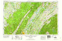
~ Chattanooga TN topo map, 1:250000 scale, 1 X 2 Degree, Historical, 1959
Chattanooga, Tennessee, USGS topographic map dated 1959.
Includes geographic coordinates (latitude and longitude). This topographic map is suitable for hiking, camping, and exploring, or framing it as a wall map.
Printed on-demand using high resolution imagery, on heavy weight and acid free paper, or alternatively on a variety of synthetic materials.
Topos available on paper, Waterproof, Poly, or Tyvek. Usually shipping rolled, unless combined with other folded maps in one order.
- Product Number: USGS-5339194
- Free digital map download (high-resolution, GeoPDF): Chattanooga, Tennessee (file size: 20 MB)
- Map Size: please refer to the dimensions of the GeoPDF map above
- Weight (paper map): ca. 55 grams
- Map Type: POD USGS Topographic Map
- Map Series: HTMC
- Map Verison: Historical
- Cell ID: 72221
- Scan ID: 148899
- Woodland Tint: Yes
- Field Check Year: 1957
- Datum: NAD27
- Map Projection: Transverse Mercator
- Map published by United States Geological Survey
- Map Language: English
- Scanner Resolution: 600 dpi
- Map Cell Name: Chattanooga
- Grid size: 1 X 2 Degree
- Date on map: 1959
- Map Scale: 1:250000
- Geographical region: Tennessee, United States
Neighboring Maps:
All neighboring USGS topo maps are available for sale online at a variety of scales.
Spatial coverage:
Topo map Chattanooga, Tennessee, covers the geographical area associated the following places:
- Black Oak - Laurelburg - Pond Grove - Acme Mill - Iron Divide (historical) - Ten Mile - Hickory Grove - Hillsboro - Brainerd - Grandview - Pleasant Hill - Wolf Creek - Milo - Pattie Gap (historical) - Chestnut Grove - Oak Grove - Cute (historical) - Riddles Store - Bratchers Crossroads - Dent Acres - Hillcrest - Bergmantown - Blue Springs - Freemont - Dodson - Savannah Peninsula - Mountainbrook - Postelle - Lantana - Union Grove - Bethany - Shepherd Forest - Bartlebaugh - Piedmont - Berkshire Wood - McGeetown - Belltown - Audubon Hills - Waterhaven - Harrican (historical) - Edgewater - Sweetgum - Ogden - Shiloh - Edgemont Forest - Campaign - Ipe (historical) - Irwinton Shores - Lakeside - Lee Estates - Shorewood - Hidden Valley - Pinebrook Estates - Tranquillity - Dibrell - Clover Hill Estates - Apalachia - Lakeharbor - Blue Ridge View - Union - Point Harbor - Snow Hill - South Dayton - Pleasant View - Dallas Heights - Big Piney - Lakewood - Carriage Hill - Lake Village - Hillsview - Westview Heights - Dallas Crest - Half Moon Shores - Lakeland Subdivision - Boyd - Marimont - West Mill - Midway - Hartland Estates - Clearwater Acres - Wexford Downs - Cumberland Spring - Renegade - Hiddenbrook - Elkhead - Tall Oaks Mobile Home Park - Belltown Hill - Oak Hill - Toqua - Rothwood - Barton Mill - Loudon - Red Hill - Union Grove - Gath - West Knoxville Mobile Park - Concord Heights - Huntingdon Forest - Riverbend Estates - Sweetwater
- Map Area ID: AREA3635-86-84
- Northwest corner Lat/Long code: USGSNW36-86
- Northeast corner Lat/Long code: USGSNE36-84
- Southwest corner Lat/Long code: USGSSW35-86
- Southeast corner Lat/Long code: USGSSE35-84
- Northern map edge Latitude: 36
- Southern map edge Latitude: 35
- Western map edge Longitude: -86
- Eastern map edge Longitude: -84


