
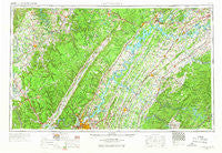
~ Chattanooga TN topo map, 1:250000 scale, 1 X 2 Degree, Historical, 1957, updated 1966
Chattanooga, Tennessee, USGS topographic map dated 1957.
Includes geographic coordinates (latitude and longitude). This topographic map is suitable for hiking, camping, and exploring, or framing it as a wall map.
Printed on-demand using high resolution imagery, on heavy weight and acid free paper, or alternatively on a variety of synthetic materials.
Topos available on paper, Waterproof, Poly, or Tyvek. Usually shipping rolled, unless combined with other folded maps in one order.
- Product Number: USGS-5339188
- Free digital map download (high-resolution, GeoPDF): Chattanooga, Tennessee (file size: 19 MB)
- Map Size: please refer to the dimensions of the GeoPDF map above
- Weight (paper map): ca. 55 grams
- Map Type: POD USGS Topographic Map
- Map Series: HTMC
- Map Verison: Historical
- Cell ID: 72221
- Scan ID: 148896
- Imprint Year: 1966
- Woodland Tint: Yes
- Edit Year: 1965
- Field Check Year: 1957
- Datum: Unstated
- Map Projection: Transverse Mercator
- Map published by United States Geological Survey
- Map Language: English
- Scanner Resolution: 600 dpi
- Map Cell Name: Chattanooga
- Grid size: 1 X 2 Degree
- Date on map: 1957
- Map Scale: 1:250000
- Geographical region: Tennessee, United States
Neighboring Maps:
All neighboring USGS topo maps are available for sale online at a variety of scales.
Spatial coverage:
Topo map Chattanooga, Tennessee, covers the geographical area associated the following places:
- Hiawatha Subdivision - Sartain Springs - Bethesda - Northwest Acres - Plum Creek - Cedar Springs - Reesetown - Georgetown - Brakebill (historical) - Fairview - Iron Divide (historical) - Woodstock Estates - Volunteer Heights - Laurel Creek - Bryan Hill - Grassland Addition - Leedom (historical) - Ela Wada Terrace - Poindexter Heights - Burton Mill - Opossum Creek Pines - Centersville - Smithfield - Harrison Addition - Wood Creek West - Clarktown - Hopewell Estates - Greentown - Shenandoah - River Bend Estates - Orchard Valley Estates - Westlyn - Rabbit Bluff (historical) - Lakewood - Parkway Estates - Hubbards Cove - New Midway - Cardiff - Grace (historical) - Clearwater Acres - Pleasant View Estates - Melville - Madisonville - Ewing (historical) - Summit - Notchy Creek - Schoolfield (historical) - Brashears Subdivision - Timberlinks - Bennett Acres - Goosetown - Sequatchie - Tariffville - Shannon Hills - Jasper - Ridgewood Acres - Hiddenbrook - Cold Spring - Black Fox - Howardville - Windsor Park - Benton Springs - Dill - Highland Manor - Johnsonville - Caneridge (historical) - Pond Grove - Yorktown Woods - Holly Springs - Sequoyah Heights - Lake Crest - Belk - Richland Crest - Fairfax Heights - Livesay - Hambright - Keltonburg - Homestead Acres - Blue Springs Resort - Mint - Dogwood Heights - Hickory Woods - Rainy (historical) - Eastwood Acres - Hickory Valley - Hamburg - Auburn Hills - Gulfwood - Whitwell - Daus - Cloverdale Estates - Ebenezer - Oakdale - Daddys Creek - Indian Hills - Waucheesi - Grandview - Glendale - Louisville - Rennbore
- Map Area ID: AREA3635-86-84
- Northwest corner Lat/Long code: USGSNW36-86
- Northeast corner Lat/Long code: USGSNE36-84
- Southwest corner Lat/Long code: USGSSW35-86
- Southeast corner Lat/Long code: USGSSE35-84
- Northern map edge Latitude: 36
- Southern map edge Latitude: 35
- Western map edge Longitude: -86
- Eastern map edge Longitude: -84


