
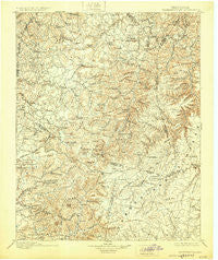
~ Standingstone TN topo map, 1:125000 scale, 30 X 30 Minute, Historical, 1898, updated 1929
Standingstone, Tennessee, USGS topographic map dated 1898.
Includes geographic coordinates (latitude and longitude). This topographic map is suitable for hiking, camping, and exploring, or framing it as a wall map.
Printed on-demand using high resolution imagery, on heavy weight and acid free paper, or alternatively on a variety of synthetic materials.
Topos available on paper, Waterproof, Poly, or Tyvek. Usually shipping rolled, unless combined with other folded maps in one order.
- Product Number: USGS-5339158
- Free digital map download (high-resolution, GeoPDF): Standingstone, Tennessee (file size: 9 MB)
- Map Size: please refer to the dimensions of the GeoPDF map above
- Weight (paper map): ca. 55 grams
- Map Type: POD USGS Topographic Map
- Map Series: HTMC
- Map Verison: Historical
- Cell ID: 66684
- Scan ID: 153553
- Imprint Year: 1929
- Survey Year: 1895
- Datum: NAD
- Map Projection: Polyconic
- Map published by United States Geological Survey
- Map Language: English
- Scanner Resolution: 600 dpi
- Map Cell Name: Standing Stone
- Grid size: 30 X 30 Minute
- Date on map: 1898
- Map Scale: 1:125000
- Geographical region: Tennessee, United States
Neighboring Maps:
All neighboring USGS topo maps are available for sale online at a variety of scales.
Spatial coverage:
Topo map Standingstone, Tennessee, covers the geographical area associated the following places:
- Columbia Hill - Campbell Junction - Parker Ford - Bowman - Cravenstown - Suntree Subdivision - Lovejoy - Foot (historical) - Fairview - Sulphur - Pleasant Ridge - Shenandoah Estates - Dry Valley - Highland - Boatland - Beaver Hill - Taylors - Netherlands (historical) - North Crossville Addition - Wilder - Henard (historical) - Honeycutt Estates - Country Club Estates - Wirmingham - Standingstone - Union Hill - Laurel Park - Allred - Fairview Estates - Holly Springs - Burton Estates - East Lake Estates - White Plains - Windle - Glenobey - Selby (historical) - Candyland Estates - Obey City - Camp Ground - Poplar Grove - Independence - Plateau - Clarkrange - Shennon Village - Spring Hill - Mount Herman - Beverly Hills - Waterloo - Green Valley - Village Green - Rays - Eastport - Bilbrey Park - Rocky Ridge - Nettle Carrier (historical) - Grey (historical) - Hillwood Estates - Burnett - Pines (historical) - Hargiss - Rhyan Springs - Manson - Bonsack - Bangham - Drowning Creek - The Lowlands - Parragon - Bangham Village - Rocky Point - Walnut Grove - Twinton - Bushing (historical) - Hanging Limb - Mill Creek - Shady Grove - Cedar Spring - Phillips Subdivision - Allons - Unity - Westfork (historical) - Poinsettia Subdivision - Lake Valley - Wagonda Hills - Peekville (historical) - Countryside Estates - Pomona Road - Goffton - Rickman - Garmar Subdivision - Jeremiah - Maddux Farm - Lee (historical) - Eagle Creek (historical) - Anderson - Howard Chapel - Terry Subdivision - Timothy - Qualls (historical) - Cullom (historical) - Winona
- Map Area ID: AREA36.536-85.5-85
- Northwest corner Lat/Long code: USGSNW36.5-85.5
- Northeast corner Lat/Long code: USGSNE36.5-85
- Southwest corner Lat/Long code: USGSSW36-85.5
- Southeast corner Lat/Long code: USGSSE36-85
- Northern map edge Latitude: 36.5
- Southern map edge Latitude: 36
- Western map edge Longitude: -85.5
- Eastern map edge Longitude: -85


