
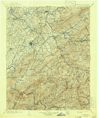
~ Roan Mountain TN topo map, 1:125000 scale, 30 X 30 Minute, Historical, 1904, updated 1942
Roan Mountain, Tennessee, USGS topographic map dated 1904.
Includes geographic coordinates (latitude and longitude). This topographic map is suitable for hiking, camping, and exploring, or framing it as a wall map.
Printed on-demand using high resolution imagery, on heavy weight and acid free paper, or alternatively on a variety of synthetic materials.
Topos available on paper, Waterproof, Poly, or Tyvek. Usually shipping rolled, unless combined with other folded maps in one order.
- Product Number: USGS-5339134
- Free digital map download (high-resolution, GeoPDF): Roan Mountain, Tennessee (file size: 11 MB)
- Map Size: please refer to the dimensions of the GeoPDF map above
- Weight (paper map): ca. 55 grams
- Map Type: POD USGS Topographic Map
- Map Series: HTMC
- Map Verison: Historical
- Cell ID: 66486
- Scan ID: 155958
- Imprint Year: 1942
- Survey Year: 1902
- Datum: Unstated
- Map Projection: Polyconic
- Map published by United States Geological Survey
- Map Language: English
- Scanner Resolution: 600 dpi
- Map Cell Name: Room Mountain
- Grid size: 30 X 30 Minute
- Date on map: 1904
- Map Scale: 1:125000
- Geographical region: Tennessee, United States
Neighboring Maps:
All neighboring USGS topo maps are available for sale online at a variety of scales.
Spatial coverage:
Topo map Roan Mountain, Tennessee, covers the geographical area associated the following places:
- Big Spring - Gouge (historical) - Oak Grove - Belmont Acres - Bent Creek - Oak Park - Camelot - Roan Hill - Tamarack - Hillmont Heights - Big Valley Mobile Home Park - Roan Mountain - Cleavet Springs (historical) - Sumpter (historical) - Sunset - Three Mountains - Cloudland (historical) - Temple Hill - Riovista - Roaring Creek - Sherwood Forest - Camp Wildwood - Fordville (historical) - Cherokee Gardens - Princeton - Watauga - Hillcrest - Cooktown - Gross Crossroad - Rock Creek - Ramblewood - Sioux - Oakland Gardens - Greenacres - Royal Pines - Westover Hills - Hunter - Blevins - Holmes - Peppers - Southwest Addition - Tipton Hill - Glen Ayre - Cedar Grove - Boone Trail - Morgan Branch - Kitzmiller (historical) - February - Dry Creek - Montclair - East Side - Hillrise - Evergreen - Pine Hills - Bemberg - Valley Forge - Garber - Y Section - Relief - Bel Air One - Seaton Subdivision - Gray - Bailey - Indian Creek (historical) - Keebler Crossroads - Keenburg - Chinquapin Grove - Pleasant Garden - Odemville (historical) - Rolling Hills - Watauga Valley - East Park - S E Miller Subdivision - Vanover Park - Buckstone Hills - College Park - Clarrissa - Plato - Barnetts - Braemar - Greene Cove - Unaka Springs - Meadowview - Westwood-Gray Subdivision - Gap Creek - Smith Shoals Subdivision - Englewood - Hale - Colby (historical) - Flourville - Seminole Woods - Greenwood - Oak Grove Village Mobile Home Park - Gomp Addition - Woodstone - Peterson - Melrose - Spear - Maison - Washington Heights
- Map Area ID: AREA36.536-82.5-82
- Northwest corner Lat/Long code: USGSNW36.5-82.5
- Northeast corner Lat/Long code: USGSNE36.5-82
- Southwest corner Lat/Long code: USGSSW36-82.5
- Southeast corner Lat/Long code: USGSSE36-82
- Northern map edge Latitude: 36.5
- Southern map edge Latitude: 36
- Western map edge Longitude: -82.5
- Eastern map edge Longitude: -82


