
~ Roan Mountain TN topo map, 1:125000 scale, 30 X 30 Minute, Historical, 1904, updated 1922
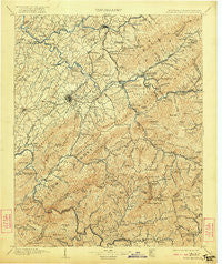
Roan Mountain, Tennessee, USGS topographic map dated 1904.
Includes geographic coordinates (latitude and longitude). This topographic map is suitable for hiking, camping, and exploring, or framing it as a wall map.
Printed on-demand using high resolution imagery, on heavy weight and acid free paper, or alternatively on a variety of synthetic materials.
Topos available on paper, Waterproof, Poly, or Tyvek. Usually shipping rolled, unless combined with other folded maps in one order.
- Product Number: USGS-5339132
- Free digital map download (high-resolution, GeoPDF): Roan Mountain, Tennessee (file size: 10 MB)
- Map Size: please refer to the dimensions of the GeoPDF map above
- Weight (paper map): ca. 55 grams
- Map Type: POD USGS Topographic Map
- Map Series: HTMC
- Map Verison: Historical
- Cell ID: 66486
- Scan ID: 153540
- Imprint Year: 1922
- Survey Year: 1902
- Datum: Unstated
- Map Projection: Unstated
- Map published by United States Geological Survey
- Map Language: English
- Scanner Resolution: 600 dpi
- Map Cell Name: Room Mountain
- Grid size: 30 X 30 Minute
- Date on map: 1904
- Map Scale: 1:125000
- Geographical region: Tennessee, United States
Neighboring Maps:
All neighboring USGS topo maps are available for sale online at a variety of scales.
Spatial coverage:
Topo map Roan Mountain, Tennessee, covers the geographical area associated the following places:
- Greene Cove - Tipton Hill - Hickory Lake - Avondale Forest - Bent Creek - West Oakland Park - Shenandoah Heights - Rayon Terrace - Underwood Springs (historical) - Buckstone Hills - Southwest Addition - Hunter - Roan Hill - East Park - Bailey - Sugar Hollow - Wellington Park - Riverside - Greenacres - Hillrise - Tolley Town - N C Love Addition - Oakland Gardens - Knob Creek Mill - Whitehead Hill - Silver Grove - Wayfield - College Park - Greenwood - Limestone Cove - Harrell Hill - Spear - Roaring Creek - Dry Creek - Buladean - Rural Ridge - McKinney Cove - Georgia Terrace - Watauga Flats - Big Valley Mobile Home Park - Camelot Two - Glen Ridge - Barnes - Flourville - Greenfield Heights - McKinley - Siam - Childress - Riovista - Whitson - The Y - Towne Acres - Keystone - Hampton - Wilbur - Ramblewood - Indian Creek (historical) - Little Rock Creek (historical) - Millercrest - Grandview - Big Cherokee - Gross Crossroad - Melrose - Gap Run - Sandy Ridge Mobile Home Park - White Rock - Sumpter (historical) - Temple Hill - Embreeville - Austin Springs - Peterson - Red Hill - S And D Mobile Home Park - Fairview - Upper Poplar - Valley Park - Kitzmiller (historical) - Piney Flats - Holston - Lake Crest - Woodlawn - Valley Forge - Horseshoe - Asbury - Okolona Estates - Squawberry - Clark Manor - Oak Grove - Maison - Chestoa - Valley - Strawberry Fields - Miller - Laban (historical) - Piney Grove - Little Cherokee - Timber Ridge - Hilton (historical) - Meadowbrook Mobile Home Park - Fish Springs
- Map Area ID: AREA36.536-82.5-82
- Northwest corner Lat/Long code: USGSNW36.5-82.5
- Northeast corner Lat/Long code: USGSNE36.5-82
- Southwest corner Lat/Long code: USGSSW36-82.5
- Southeast corner Lat/Long code: USGSSE36-82
- Northern map edge Latitude: 36.5
- Southern map edge Latitude: 36
- Western map edge Longitude: -82.5
- Eastern map edge Longitude: -82


