
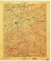
~ Roan Mountain TN topo map, 1:125000 scale, 30 X 30 Minute, Historical, 1904, updated 1912
Roan Mountain, Tennessee, USGS topographic map dated 1904.
Includes geographic coordinates (latitude and longitude). This topographic map is suitable for hiking, camping, and exploring, or framing it as a wall map.
Printed on-demand using high resolution imagery, on heavy weight and acid free paper, or alternatively on a variety of synthetic materials.
Topos available on paper, Waterproof, Poly, or Tyvek. Usually shipping rolled, unless combined with other folded maps in one order.
- Product Number: USGS-5339130
- Free digital map download (high-resolution, GeoPDF): Roan Mountain, Tennessee (file size: 11 MB)
- Map Size: please refer to the dimensions of the GeoPDF map above
- Weight (paper map): ca. 55 grams
- Map Type: POD USGS Topographic Map
- Map Series: HTMC
- Map Verison: Historical
- Cell ID: 66486
- Scan ID: 153538
- Imprint Year: 1912
- Survey Year: 1902
- Datum: Unstated
- Map Projection: Unstated
- Map published by United States Geological Survey
- Map Language: English
- Scanner Resolution: 600 dpi
- Map Cell Name: Room Mountain
- Grid size: 30 X 30 Minute
- Date on map: 1904
- Map Scale: 1:125000
- Geographical region: Tennessee, United States
Neighboring Maps:
All neighboring USGS topo maps are available for sale online at a variety of scales.
Spatial coverage:
Topo map Roan Mountain, Tennessee, covers the geographical area associated the following places:
- Erwin - Pierce - Buckstone Hills - Herrell (historical) - Kansas City - Little Milligan - Bluff City - Bakersville - Harrell Hill - Richlands - Sunset - New Bethel - Wayfield - Wilbur - Walnut Grove - Okolona - College Park - Greenfields - Limestone Cove - Childress - Butler - Fairview - Webb - Bel Air Two - Fairview - White Rock - Oak Park - Avondale Forest - Watauga Valley - Clark Manor - McKinley Mobile Home Park - Westover Hills - Crouch Crossroad - Woodby Hill - Thom (historical) - Toecane - Princeton Hills - Buladean - Cedar Grove - High Health (historical) - Sherwood Forest - Sandy Ridge Mobile Home Park - Hulan Hollow - Miller - Rexford (historical) - Pine Timbers - Milligan - Plato - Ramblewood - Shell Creek - Galloway Mill - Lillydale - Oak Grove - Powder Branch - Siam - Watauga Point - Charity Hill - Kittyton (historical) - West Oakland Park - Big Cherokee - Love Station - Knob Creek Mill - Holmes - Buffalo View - Greenacres - Pine Hills - Hiwassee Heights - Beech Bottom - Camp Wildwood - South Gate Village - Plymouth Park - Cedar Grove - Carter Crossing - Upper Poplar - Big Spring - Westwood-Gray Subdivision - Blevins - Samuel (historical) - Princeton - Greene Cove - Oak Hill - Flourville - Cat Island - Buffalo Ridge (historical) - Hopson - Little Cherokee - Evergreen - Relief - Fairlawn - East Park - Watauga - Gouge (historical) - Meadowview - Fish Springs - Brentwood - Piney Grove - Idlewilde - Reeves - Towne Acres - Strawberry Fields
- Map Area ID: AREA36.536-82.5-82
- Northwest corner Lat/Long code: USGSNW36.5-82.5
- Northeast corner Lat/Long code: USGSNE36.5-82
- Southwest corner Lat/Long code: USGSSW36-82.5
- Southeast corner Lat/Long code: USGSSE36-82
- Northern map edge Latitude: 36.5
- Southern map edge Latitude: 36
- Western map edge Longitude: -82.5
- Eastern map edge Longitude: -82


