
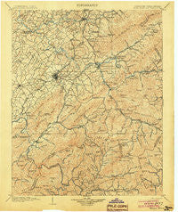
~ Roan Mountain TN topo map, 1:125000 scale, 30 X 30 Minute, Historical, 1904
Roan Mountain, Tennessee, USGS topographic map dated 1904.
Includes geographic coordinates (latitude and longitude). This topographic map is suitable for hiking, camping, and exploring, or framing it as a wall map.
Printed on-demand using high resolution imagery, on heavy weight and acid free paper, or alternatively on a variety of synthetic materials.
Topos available on paper, Waterproof, Poly, or Tyvek. Usually shipping rolled, unless combined with other folded maps in one order.
- Product Number: USGS-5339128
- Free digital map download (high-resolution, GeoPDF): Roan Mountain, Tennessee (file size: 11 MB)
- Map Size: please refer to the dimensions of the GeoPDF map above
- Weight (paper map): ca. 55 grams
- Map Type: POD USGS Topographic Map
- Map Series: HTMC
- Map Verison: Historical
- Cell ID: 66486
- Scan ID: 153537
- Survey Year: 1902
- Datum: Unstated
- Map Projection: Unstated
- Map published by United States Geological Survey
- Map Language: English
- Scanner Resolution: 600 dpi
- Map Cell Name: Room Mountain
- Grid size: 30 X 30 Minute
- Date on map: 1904
- Map Scale: 1:125000
- Geographical region: Tennessee, United States
Neighboring Maps:
All neighboring USGS topo maps are available for sale online at a variety of scales.
Spatial coverage:
Topo map Roan Mountain, Tennessee, covers the geographical area associated the following places:
- Sequoyah Heights - Watauga Valley - Ramblewood - Gouge (historical) - Davis Springs - Monterey Hills - Whitson - Asbury - Roan Mountain - Vanover Park - Onks - Hillcrest - Holly Hill - Evergreen - Gilmer Park - Honeycutt - Ephraim Place - S E Miller Subdivision - Ramseytown - Bitter End - Plumtree - Whitehead Hill - Princeton - Hilton (historical) - Spear - Crouch Crossroad - Three Mountains - Sugar Hollow - Riverside - East Park - Bakersville - Embreeville - Heaton Creek - Elizabethton - Garland Acres - Buladeen - Milligan - Little Milligan - Sumpter (historical) - Bel Air One - Tanglewood - South Ridge Estates - East Side - Englewood - Keenburg - Hale - Rock Creek - Reston Court - Fairview - Chestoa - Woodby Hill - East Ridge - Midway - Sherwood Forest - Galloway Mill - Rocky Springs - Unicoi - Whispering Pines - Roaring Creek - Erwin - Relief - Rexford (historical) - Roundtree - Banner Hill - Garber - River Hill - Riovista - Range - Gap Creek - Clark Manor - Colby (historical) - Greenfields - Sinking Creek - Cove Creek - Glen Ridge - Baker Bluff Subdivision - Pine Ridge - West Hills - Wahoo (historical) - Hidden Oaks - Oak Park - Cat Island - Pine Timbers - Lillydale - Kansas City - Hill-N-Dale - Clarrissa - Underwood Springs (historical) - Maison - Hickory Tree - Shallowford - S And D Mobile Home Park - Huntdale - Wildwood - Winner - Arbor Heights - Sunset - Green Pine - Pine Hills - McKinley Mobile Home Park
- Map Area ID: AREA36.536-82.5-82
- Northwest corner Lat/Long code: USGSNW36.5-82.5
- Northeast corner Lat/Long code: USGSNE36.5-82
- Southwest corner Lat/Long code: USGSSW36-82.5
- Southeast corner Lat/Long code: USGSSE36-82
- Northern map edge Latitude: 36.5
- Southern map edge Latitude: 36
- Western map edge Longitude: -82.5
- Eastern map edge Longitude: -82


