
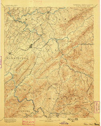
~ Roan Mountain TN topo map, 1:125000 scale, 30 X 30 Minute, Historical, 1894, updated 1898
Roan Mountain, Tennessee, USGS topographic map dated 1894.
Includes geographic coordinates (latitude and longitude). This topographic map is suitable for hiking, camping, and exploring, or framing it as a wall map.
Printed on-demand using high resolution imagery, on heavy weight and acid free paper, or alternatively on a variety of synthetic materials.
Topos available on paper, Waterproof, Poly, or Tyvek. Usually shipping rolled, unless combined with other folded maps in one order.
- Product Number: USGS-5339124
- Free digital map download (high-resolution, GeoPDF): Roan Mountain, Tennessee (file size: 9 MB)
- Map Size: please refer to the dimensions of the GeoPDF map above
- Weight (paper map): ca. 55 grams
- Map Type: POD USGS Topographic Map
- Map Series: HTMC
- Map Verison: Historical
- Cell ID: 66486
- Scan ID: 153535
- Imprint Year: 1898
- Survey Year: 1888
- Datum: Unstated
- Map Projection: Unstated
- Map published by United States Geological Survey
- Map Language: English
- Scanner Resolution: 600 dpi
- Map Cell Name: Room Mountain
- Grid size: 30 X 30 Minute
- Date on map: 1894
- Map Scale: 1:125000
- Geographical region: Tennessee, United States
Neighboring Maps:
All neighboring USGS topo maps are available for sale online at a variety of scales.
Spatial coverage:
Topo map Roan Mountain, Tennessee, covers the geographical area associated the following places:
- Valley - Camp Wildwood - Buffalo View - Greenacres - South Ridge Estates - Boones Creek - Gray - Spring City Mobile Home Park - Brownlow (historical) - Shenandoah Heights - Marbleton - Buckstone Hills - Peterson - Breezy Hills - Peppers - Davis Springs - Clarrissa - Little Milligan - Three Mountains - Bel Air Two - Sandy Ridge Mobile Home Park - Martindale Estates - Tolley Town - Bitter End - Asbury - Forest View - Winner - Georgia Terrace - Tiger Valley - Siam - Skyline Heights - Elizabethton - Pleasant Garden - Chinquapin Grove - Hiwassee Heights - Strawberry Fields - Bumpus Cove - Camelot Two - Carter Crossing - Meadowbrook Mobile Home Park - Watauga Valley - Hampton - Sioux - Mayday - Plato - Princeton - Richlands - Midway - The Y - Barnetts - Lillydale - Roundtree - Oakland Village - Cherokee Gardens - Crabtree - Pine Ridge - Indian Creek (historical) - Charbray - New Bethel - Plymouth Park - Westover - Tipton Hill - White Rock - Harrell Hill - Limestone Cove - Dogwood Acres - Sugar Hollow - Dry Creek - Woodstone - Belmont Acres - Blue Spring - Princeton Hills - Cloudland (historical) - S And D Mobile Home Park - Oak Grove - Childress - Carmol - Sherwood Forest - N C Love Addition - Biltmore - Erwin - Keebler Crossroads - Greenwood - Piney Grove - Laurel Fork - Riovista - Millercrest - Cherokee Hills - Fish Springs - Butler - Gap Run - Ramblewood - East Park - Holston - Rexford (historical) - Wilbur - Bluff City - Carmel Village - Whiting (historical) - Green Pine
- Map Area ID: AREA36.536-82.5-82
- Northwest corner Lat/Long code: USGSNW36.5-82.5
- Northeast corner Lat/Long code: USGSNE36.5-82
- Southwest corner Lat/Long code: USGSSW36-82.5
- Southeast corner Lat/Long code: USGSSE36-82
- Northern map edge Latitude: 36.5
- Southern map edge Latitude: 36
- Western map edge Longitude: -82.5
- Eastern map edge Longitude: -82


