
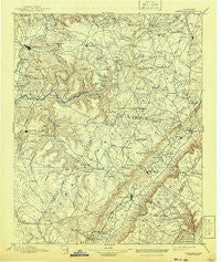
~ Pikeville TN topo map, 1:125000 scale, 30 X 30 Minute, Historical, 1895, updated 1941
Pikeville, Tennessee, USGS topographic map dated 1895.
Includes geographic coordinates (latitude and longitude). This topographic map is suitable for hiking, camping, and exploring, or framing it as a wall map.
Printed on-demand using high resolution imagery, on heavy weight and acid free paper, or alternatively on a variety of synthetic materials.
Topos available on paper, Waterproof, Poly, or Tyvek. Usually shipping rolled, unless combined with other folded maps in one order.
- Product Number: USGS-5339116
- Free digital map download (high-resolution, GeoPDF): Pikeville, Tennessee (file size: 7 MB)
- Map Size: please refer to the dimensions of the GeoPDF map above
- Weight (paper map): ca. 55 grams
- Map Type: POD USGS Topographic Map
- Map Series: HTMC
- Map Verison: Historical
- Cell ID: 66330
- Scan ID: 155955
- Imprint Year: 1941
- Survey Year: 1890
- Datum: Unstated
- Map Projection: Polyconic
- Map published by United States Geological Survey
- Map Language: English
- Scanner Resolution: 600 dpi
- Map Cell Name: Pikeville
- Grid size: 30 X 30 Minute
- Date on map: 1895
- Map Scale: 1:125000
- Geographical region: Tennessee, United States
Neighboring Maps:
All neighboring USGS topo maps are available for sale online at a variety of scales.
Spatial coverage:
Topo map Pikeville, Tennessee, covers the geographical area associated the following places:
- Oak Hill - Music (historical) - Crossville - Meadowview - Seals (historical) - Lynwood Acres - Smith Chapel - Claysville - Highland Estates - Gillentine (historical) - Dunrovin Estates - Meade (historical) - Middle Brook Place - Phiferes - Clifty - Ridgedale - Sweetgum - Pleasant Hill - Olio (historical) - Old Cumberland - Brookhaven - Bon Air - Pine Creek - Mount Vernon Estates - Parham - White Oak Forest - Caney Forks - Big Lick - Greenwood - Burke - Pleasant View Estates - Seminole Subdivision - Eastland - Stringtown - Port Haven - Summer City - Wyatt (historical) - West Mill - Old Winesap - Pomona - Ravenscroft - Mooneyham - Hale Mill - Emery Mill - Phillps Subdivision - Ojibwa Subdivision - Griffith - Mobra - Oneida Subdivision - De Rossett - Cranmore Cove - Lake Genesis Country - Sequatchie College - Obed River Estates - Sampson - Lees Station - Lake Park - Howard Springs - Young (historical) - Hart (historical) - Cooper Mill - Sparta Hills - Midway - Lake Tansi Village - Taylors Chapel - Town Branch Estates - Tiptop - Livesay - Neverfail (historical) - Mount Gilead (historical) - Simpsons - Luminary - Ninemile - Pearson (historical) - Bethesda - Oakdale - Rainy (historical) - Hickory Hills - Rainbow Hills - Foxfire - Pine Grove - Wild Plum - New Era - Harrison Addition - Mount Crest - Pikeville - Whispering Hills - Rolling Hills - Dodson - Methodist (historical) - The Meadows - Kiowa Subdivision - Dill - Litton - Nicholson Heights - Dixieland - Perilla (historical) - Rolling Acres - Browntown - Cumberland Spring
- Map Area ID: AREA3635.5-85.5-85
- Northwest corner Lat/Long code: USGSNW36-85.5
- Northeast corner Lat/Long code: USGSNE36-85
- Southwest corner Lat/Long code: USGSSW35.5-85.5
- Southeast corner Lat/Long code: USGSSE35.5-85
- Northern map edge Latitude: 36
- Southern map edge Latitude: 35.5
- Western map edge Longitude: -85.5
- Eastern map edge Longitude: -85


