
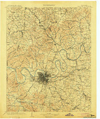
~ Nashville TN topo map, 1:125000 scale, 30 X 30 Minute, Historical, 1903
Nashville, Tennessee, USGS topographic map dated 1903.
Includes geographic coordinates (latitude and longitude). This topographic map is suitable for hiking, camping, and exploring, or framing it as a wall map.
Printed on-demand using high resolution imagery, on heavy weight and acid free paper, or alternatively on a variety of synthetic materials.
Topos available on paper, Waterproof, Poly, or Tyvek. Usually shipping rolled, unless combined with other folded maps in one order.
- Product Number: USGS-5339100
- Free digital map download (high-resolution, GeoPDF): Nashville, Tennessee (file size: 10 MB)
- Map Size: please refer to the dimensions of the GeoPDF map above
- Weight (paper map): ca. 55 grams
- Map Type: POD USGS Topographic Map
- Map Series: HTMC
- Map Verison: Historical
- Cell ID: 65604
- Scan ID: 153479
- Survey Year: 1901
- Datum: Unstated
- Map Projection: Unstated
- Map published by United States Geological Survey
- Map Language: English
- Scanner Resolution: 600 dpi
- Map Cell Name: Greenbrier
- Grid size: 30 X 30 Minute
- Date on map: 1903
- Map Scale: 1:125000
- Geographical region: Tennessee, United States
Neighboring Maps:
All neighboring USGS topo maps are available for sale online at a variety of scales.
Spatial coverage:
Topo map Nashville, Tennessee, covers the geographical area associated the following places:
- Mount View - Settlers Knob - Steeple Chase Farms - Gilroy (historical) - Two Chestnut - Castlegate Estates - Edge-O-Lake Estates - Brookview Estates - Wrencoe - Jimtown (historical) - Forest Hills - Oakmont - Mudtavern - Cherry Hills - Morningside Acres - Centralville (historical) - Twin Valley - Curtiswood - La Vergne - Oakwood Terrace - Bethlehem - Avondale - Millersville - Natchez Hills Estate - Johnsons Crossroads - Driftwood Park - Lankford Farms - Murray Estates - Dalemere - Rosebank - Heathrow - Ponderosa - Clearview - Oak Hampton - Mizell (historical) - Indian Forest - Brooklyn Heights - Sunnyside Estates - Huntington Ridge Estates - Meadowlake - Iroquois Estates - Dry Fork (historical) - Indian Lake Forest - Northcreek Commons - Sherwood Forest - Old Hickory - Denny Hills - Lynn Christie - Cambridge Hills - Walton (historical) - Woodbine - Tyree Springs (historical) - Vaughns Gap - Rosewood - Bakers - Glencliff - Woodlake - Lakewood - Glendale Park - White House - West Nashville - Barclay Square - Belle Meade - Courtland - Una - Couchville - The Maples - Bethany Hills - Town Park Estates - Country Club Estates - Madison - Pleasant Grove - Georgemere - Ridgepost (historical) - Red Bud - Point O'View - West - Raintree Forest - Brentwood Park - Peytona - Avondale - Pickens Acres - Deerwood - Rural Hill - In-A-Vale-Estates - Nashboro Village - Jefferson Pike - Creekmont - Moreland Farms - Dunkled Estates - Jackson Hollow - Richland - Oak Hill Estates - Gertrude (historical) - Cloverland Acres - Cane Ridge - Langford Cove - Sneed Glen - Monte Carlo Estates - Station Camp (historical)
- Map Area ID: AREA36.536-87-86.5
- Northwest corner Lat/Long code: USGSNW36.5-87
- Northeast corner Lat/Long code: USGSNE36.5-86.5
- Southwest corner Lat/Long code: USGSSW36-87
- Southeast corner Lat/Long code: USGSSE36-86.5
- Northern map edge Latitude: 36.5
- Southern map edge Latitude: 36
- Western map edge Longitude: -87
- Eastern map edge Longitude: -86.5


