
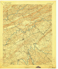
~ Morristown TN topo map, 1:125000 scale, 30 X 30 Minute, Historical, 1895, updated 1922
Morristown, Tennessee, USGS topographic map dated 1895.
Includes geographic coordinates (latitude and longitude). This topographic map is suitable for hiking, camping, and exploring, or framing it as a wall map.
Printed on-demand using high resolution imagery, on heavy weight and acid free paper, or alternatively on a variety of synthetic materials.
Topos available on paper, Waterproof, Poly, or Tyvek. Usually shipping rolled, unless combined with other folded maps in one order.
- Product Number: USGS-5339066
- Free digital map download (high-resolution, GeoPDF): Morristown, Tennessee (file size: 9 MB)
- Map Size: please refer to the dimensions of the GeoPDF map above
- Weight (paper map): ca. 55 grams
- Map Type: POD USGS Topographic Map
- Map Series: HTMC
- Map Verison: Historical
- Cell ID: 66097
- Scan ID: 153462
- Imprint Year: 1922
- Survey Year: 1890
- Datum: Unstated
- Map Projection: Unstated
- Map published by United States Geological Survey
- Map Language: English
- Scanner Resolution: 600 dpi
- Map Cell Name: Morristown
- Grid size: 30 X 30 Minute
- Date on map: 1895
- Map Scale: 1:125000
- Geographical region: Tennessee, United States
Neighboring Maps:
All neighboring USGS topo maps are available for sale online at a variety of scales.
Spatial coverage:
Topo map Morristown, Tennessee, covers the geographical area associated the following places:
- Sugar Forks - Big Q Estates - Mountain View - Fuller Estates - Wood Acres - Woodcrest Hills - Wolf Acres - The Colonies - Kentucky Heights - Kathy Hills - Raven Hill - Whitesburg - Edna - Otes - Witt Acres - Emerald Acres - Alpha - Cuba - Crockett Ridge - Sunset Hills - Ottinger - Panther Hills - Idol - Wildwood - Thorn Hill - Echo Hills - Persia - Mooresburg - Kilgore Subdivision - Britton Acres - Rolling Hills - Bald Point - Willow Springs - Beulah - Bowen - Pleasant Hill - Pleasant view - Bybee - Mulberry Acres - Baneberry - Rogersville - Cloud Creek - Buell Acres - Grants Chapel - Purkey Estates - Rock Haven - Bruner Grove - Lakeshore Estates - Lilac (historical) - Arrow Hills - Lakemoore - White Pine - Shiloh - Howard Quarter - Beans - Clinchview Heights - Pate Hill - Lynndale - Fox Den - Kingswood - Hopper Bluff - Windvue Estates - Wa-Ni Village - Campbell Acres - West Hills - White Horn - Lawson Mill - West Lake Estates - East Ridge - Havley Springs - Salem - Greenhill - Dogwood Hills - Bray - Corbin Estates - Mansfield Gap - Colliers Corner - Quail Hollow - Rushy Springs - Belair - Lee Valley - Austins Mill - Alpha Heights - Marguerite - Beechnut Subdivision - Holly Hills - Bulls Gap - Dandridge - Lakeview - Meadowview - Lakemont Cabin Area - Beaver Dam (historical) - Ridgeview - Shiloh - Quarryville (historical) - Eureka Hills - Susong - Lowe Acres - Fairfield Acres - Briar Thicket
- Map Area ID: AREA36.536-83.5-83
- Northwest corner Lat/Long code: USGSNW36.5-83.5
- Northeast corner Lat/Long code: USGSNE36.5-83
- Southwest corner Lat/Long code: USGSSW36-83.5
- Southeast corner Lat/Long code: USGSSE36-83
- Northern map edge Latitude: 36.5
- Southern map edge Latitude: 36
- Western map edge Longitude: -83.5
- Eastern map edge Longitude: -83


