
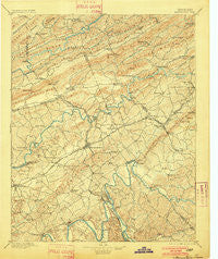
~ Morristown TN topo map, 1:125000 scale, 30 X 30 Minute, Historical, 1895, updated 1901
Morristown, Tennessee, USGS topographic map dated 1895.
Includes geographic coordinates (latitude and longitude). This topographic map is suitable for hiking, camping, and exploring, or framing it as a wall map.
Printed on-demand using high resolution imagery, on heavy weight and acid free paper, or alternatively on a variety of synthetic materials.
Topos available on paper, Waterproof, Poly, or Tyvek. Usually shipping rolled, unless combined with other folded maps in one order.
- Product Number: USGS-5339062
- Free digital map download (high-resolution, GeoPDF): Morristown, Tennessee (file size: 9 MB)
- Map Size: please refer to the dimensions of the GeoPDF map above
- Weight (paper map): ca. 55 grams
- Map Type: POD USGS Topographic Map
- Map Series: HTMC
- Map Verison: Historical
- Cell ID: 66097
- Scan ID: 153460
- Imprint Year: 1901
- Survey Year: 1890
- Datum: Unstated
- Map Projection: Unstated
- Map published by United States Geological Survey
- Map Language: English
- Scanner Resolution: 600 dpi
- Map Cell Name: Morristown
- Grid size: 30 X 30 Minute
- Date on map: 1895
- Map Scale: 1:125000
- Geographical region: Tennessee, United States
Neighboring Maps:
All neighboring USGS topo maps are available for sale online at a variety of scales.
Spatial coverage:
Topo map Morristown, Tennessee, covers the geographical area associated the following places:
- Wildwood - Avondale - Inman (historical) - Melody Acres - Henardtown - Leadvale - Idol - Sugar Forks - Tigertown - Kathy Hills - Shiloh - Panther Lake - Hunnicutt Mill - Gravelly Hill - Casablanca - Mohawk Crossroad - Pate Hill - May Springs (historical) - Eureka Hills - Nenny - Pleasant view - Panther Hills - Papaw - Springvale - Lake View Park - Otes - Hidden Acres - Willow Springs - Lake Forest Estates - Big Q Estates - Brentwood - Ritchie - Alumwell - Rushy Springs - Westview - Riverview - Smokerise - Grants Chapel - White Horn - Pineville - Rogersville - Edna - Holston Hills - Persia - Liberty Heights - Lowe Acres - Kingswood - Countryside Mobile Home Park - Cherokee Park - Rocky Point - Timbercrest - Meadow Branch - Greenhill - Fox Den - Colliers Corner - Helton - Longtown (historical) - Corbin Estates - Rankin - Lake Park - Witt - Dalton Heights - Scoot Mill - Cloud Creek - Withers Subdivision - Hillcrest - High Point - Galbraith Springs - Hallmark Estates - Klondike - The Colonies - Pleasantview Acres - Mary Chapel - Westivew Woods - Oakwood - Union Heights - Corpening HIlls - Mapleview Acres - West Lake Estates - Avondale Springs - Patterson Hills - Russellville - Bybee - Quail Hollow - Silver City - Cedar Hills - Mulberry Acres - Gaby Hills - Beaver Dam (historical) - Wa-Ni Village - Shiloh - Flat Gap - Trent Valley - North Brook - Lilac (historical) - Cherokee - Beechnut Subdivision - Lynndale - Mansfield Gap - Needmore
- Map Area ID: AREA36.536-83.5-83
- Northwest corner Lat/Long code: USGSNW36.5-83.5
- Northeast corner Lat/Long code: USGSNE36.5-83
- Southwest corner Lat/Long code: USGSSW36-83.5
- Southeast corner Lat/Long code: USGSSE36-83
- Northern map edge Latitude: 36.5
- Southern map edge Latitude: 36
- Western map edge Longitude: -83.5
- Eastern map edge Longitude: -83


