
~ Morristown TN topo map, 1:125000 scale, 30 X 30 Minute, Historical, 1895, updated 1941
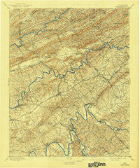
Morristown, Tennessee, USGS topographic map dated 1895.
Includes geographic coordinates (latitude and longitude). This topographic map is suitable for hiking, camping, and exploring, or framing it as a wall map.
Printed on-demand using high resolution imagery, on heavy weight and acid free paper, or alternatively on a variety of synthetic materials.
Topos available on paper, Waterproof, Poly, or Tyvek. Usually shipping rolled, unless combined with other folded maps in one order.
- Product Number: USGS-5339054
- Free digital map download (high-resolution, GeoPDF): Morristown, Tennessee (file size: 9 MB)
- Map Size: please refer to the dimensions of the GeoPDF map above
- Weight (paper map): ca. 55 grams
- Map Type: POD USGS Topographic Map
- Map Series: HTMC
- Map Verison: Historical
- Cell ID: 66097
- Scan ID: 150116
- Imprint Year: 1941
- Survey Year: 1890
- Datum: Unstated
- Map Projection: Polyconic
- Map published by United States Geological Survey
- Map Language: English
- Scanner Resolution: 600 dpi
- Map Cell Name: Morristown
- Grid size: 30 X 30 Minute
- Date on map: 1895
- Map Scale: 1:125000
- Geographical region: Tennessee, United States
Neighboring Maps:
All neighboring USGS topo maps are available for sale online at a variety of scales.
Spatial coverage:
Topo map Morristown, Tennessee, covers the geographical area associated the following places:
- Sulphur Springs - Mooresburg Springs - Cardinal Hills - Marguerite - Holston Hills - Austins Mill - Green Acres - Gaby Hills - Papaw - Cain Mill - Mary Chapel - Hyatt Acres - Rankin - Brookside Mill - Mohawk - Lakemoore - Cedar Hills - Mount Airy Springs - Beech Grove - Avondale - Emerald Acres - Thorn Hill - Carter Acres - Colliers Corner - Swann - Fairfield Acres - Spruce Pine - Point Pleasant - Belair - Idol - The Colonies - Talbott - Saint Clair - Prima Estates - Roe - Hallmark Estates - Oakland - Stithsville (historical) - Lakeshore Gardens - Cherokee - Alpha Heights - Bean Station - Fuller Estates - Caney Valley - Bray - Willow Springs - Leadvale - New Hope - Holston (historical) - Arrow Hills - Holttown - Sherwood Estates - Luther - Wood Acres - Alumwell - Coulter - Barton Springs - Depew Addition - Bluegrass - Bruner Grove - Wildwood - Tigertown - Pleasant Hill - Wolf Acres - Cuba - Raven Hill - Crockett Ridge - Dogwood Hills - Skinner Crossroad - Greenwood Acres - Windvue Estates - East Manor - Mooresburg - Roe Junction - Pate Hill - Altonville - Woodcrest Hills - Fox Den - Baneberry - Greenhill - Flat Gap - Boggs - Eureka Hills - Britton Acres - Paradise Pointe - Fairview - Union Heights - Bald Point - Quail Hollow - Ridgeview - Duck Creek - Mount Horeb - Galbraith - Melody Acres - Murrelltown - Meadow Branch - Avondale Springs - Pleasant view - Kimbrough Crossroad - May Springs (historical)
- Map Area ID: AREA36.536-83.5-83
- Northwest corner Lat/Long code: USGSNW36.5-83.5
- Northeast corner Lat/Long code: USGSNE36.5-83
- Southwest corner Lat/Long code: USGSSW36-83.5
- Southeast corner Lat/Long code: USGSSE36-83
- Northern map edge Latitude: 36.5
- Southern map edge Latitude: 36
- Western map edge Longitude: -83.5
- Eastern map edge Longitude: -83


