
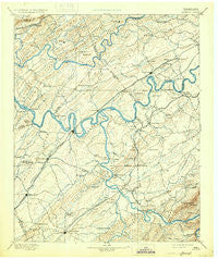
~ Loudon TN topo map, 1:125000 scale, 30 X 30 Minute, Historical, 1895, updated 1931
Loudon, Tennessee, USGS topographic map dated 1895.
Includes geographic coordinates (latitude and longitude). This topographic map is suitable for hiking, camping, and exploring, or framing it as a wall map.
Printed on-demand using high resolution imagery, on heavy weight and acid free paper, or alternatively on a variety of synthetic materials.
Topos available on paper, Waterproof, Poly, or Tyvek. Usually shipping rolled, unless combined with other folded maps in one order.
- Product Number: USGS-5339030
- Free digital map download (high-resolution, GeoPDF): Loudon, Tennessee (file size: 7 MB)
- Map Size: please refer to the dimensions of the GeoPDF map above
- Weight (paper map): ca. 55 grams
- Map Type: POD USGS Topographic Map
- Map Series: HTMC
- Map Verison: Historical
- Cell ID: 65939
- Scan ID: 153519
- Imprint Year: 1931
- Survey Year: 1891
- Datum: Unstated
- Map Projection: Polyconic
- Map published by United States Geological Survey
- Map Language: English
- Scanner Resolution: 600 dpi
- Map Cell Name: Loudon
- Grid size: 30 X 30 Minute
- Date on map: 1895
- Map Scale: 1:125000
- Geographical region: Tennessee, United States
Neighboring Maps:
All neighboring USGS topo maps are available for sale online at a variety of scales.
Spatial coverage:
Topo map Loudon, Tennessee, covers the geographical area associated the following places:
- Windsor Park - Waterhaven - Sherril Heights - Greenwood - Lanier - Lake-A-Wana - Tommotley (historical) - Clover Hill - Hidden Valley - Morganton - Eve Mills - Silver Ridge - Farrington - Riverside - Toqua - Fourmile Bridge (historical) - Vonore - Point Harbor - Thornton - Ebenezer - Laurel Bank Estates - Wedgewood Hills - Virtue - Pine Grove - Boyd - McGhee - Burchfield Heights - Walker Subdivision - Village Green - Fort Loudon Estates - Deane Hill - Hopewell Springs - Station West - Mentor - Scarboro - Cedar Springs - Twin Springs - Hopewell Mill - Mount Tabor - Lakeview - Union - Christy Hill - Lakeland Subdivision - DeArmond - Walnut Hill Estates - Hickory Hills - Burton Mill - Philadelphia - Old Sweetwater - Fairway Estates - Cherokee Heights - Loudon City Park - Vancouver (historical) - Gulfwood - West Forest - West Hills - Glen Arden - Eaton Forest - Westborough - Kingston Hills - Kensington - Blair - Fair Oaks - Heather Heights - Edington (historical) - Forest Glen - Third Creek - Sugarlimb - Beaver Creek Estates - Oak Grove - Jonesville - Arline - Cactus Cove - Hidden Hills - Rothwood - Wood Creek West - Hardin Estates - Blue Gem - Middlebrook Acres - Fairlane - Farragut - Camelot - Ten Mile - Paint Rock Farm Lake Estates - Alnwick - Suburban Hills - Sugar Grove - Oak Grove Heights - Cedar Grove - Century Acres - Mialoquo (historical) - Wooded Acres - Rockville - Imperial Estates - Oak Hills Estates - Highland Park - Antioch - Tan Rara Oesta - Smoky View Estates - Woodland Acres
- Map Area ID: AREA3635.5-84.5-84
- Northwest corner Lat/Long code: USGSNW36-84.5
- Northeast corner Lat/Long code: USGSNE36-84
- Southwest corner Lat/Long code: USGSSW35.5-84.5
- Southeast corner Lat/Long code: USGSSE35.5-84
- Northern map edge Latitude: 36
- Southern map edge Latitude: 35.5
- Western map edge Longitude: -84.5
- Eastern map edge Longitude: -84


