
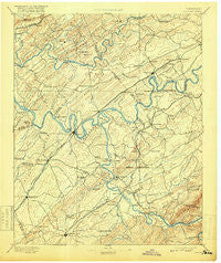
~ Loudon TN topo map, 1:125000 scale, 30 X 30 Minute, Historical, 1895, updated 1918
Loudon, Tennessee, USGS topographic map dated 1895.
Includes geographic coordinates (latitude and longitude). This topographic map is suitable for hiking, camping, and exploring, or framing it as a wall map.
Printed on-demand using high resolution imagery, on heavy weight and acid free paper, or alternatively on a variety of synthetic materials.
Topos available on paper, Waterproof, Poly, or Tyvek. Usually shipping rolled, unless combined with other folded maps in one order.
- Product Number: USGS-5339028
- Free digital map download (high-resolution, GeoPDF): Loudon, Tennessee (file size: 7 MB)
- Map Size: please refer to the dimensions of the GeoPDF map above
- Weight (paper map): ca. 55 grams
- Map Type: POD USGS Topographic Map
- Map Series: HTMC
- Map Verison: Historical
- Cell ID: 65939
- Scan ID: 153518
- Imprint Year: 1918
- Survey Year: 1891
- Datum: Unstated
- Map Projection: Unstated
- Map published by United States Geological Survey
- Map Language: English
- Scanner Resolution: 600 dpi
- Map Cell Name: Loudon
- Grid size: 30 X 30 Minute
- Date on map: 1895
- Map Scale: 1:125000
- Geographical region: Tennessee, United States
Neighboring Maps:
All neighboring USGS topo maps are available for sale online at a variety of scales.
Spatial coverage:
Topo map Loudon, Tennessee, covers the geographical area associated the following places:
- Dogwood Shores - Cedar Grove - Loudon City Park - Pine Springs - Elverton - Chilhowey (historical) - Smoky View Estates - Cactus Cove - Green Valley - Timbercrest - Middlebrook Acres - Poplar Springs - Point Harbor - New Midway - Westmoreland Heights - High Point - Blue Gem - Bucktown - Alnwick - Northshore Woods - Gooseneck - Ridgedale - Christy Hill - Mentor - Hamilton Subdivision - Hopewell Mill - Cedar Bluff - Christianburg - Harrison Hills - Coytee (historical) - Gravelly Hills - Glendale - Westavia Woods - Ewing (historical) - Miser Station - Ashley Oaks - Century Acres - Chestnut Hills - Country Estates Mobile Home Park - Old Sweetwater - Concord - Cumberland Estates - Fairway Estates - Louisville - Woodland Acres - Maple Spring - Stonebrook - Ipe (historical) - Garland - Kingston Hills - Montvue - Poplar Springs - Unitia - Lawnville Meadows - Trails End - Orchard Valley Estates - Sequoyah Estates - Lanier - Marble Hill - Armona - Coal Hill - Galewood - Kingsgate - Dixie Lee Junction - Cedar Springs - Eblen Estates - Fort Loudon Estates - Third Creek - Mialoquo (historical) - Alleghany (historical) - Mount Vernon - Green Meadow - Wellsville - Greenwood - Hidden Valley - Pumpkin Center - Choto Hills - Rothwood - Dyllis - Hardin Estates - Friendsville - Philadelphia - Gulf Park - Marmor - Martel Estates East - McGhee - Hartland Estates - Imperial Estates - Halfway Town (historical) - Bestview - Northpoint - Mint - Oak Grove - Kiser - Wedgewood Hills - Fairview - Oral - Robinson Mill - Brashears Subdivision - West Hills
- Map Area ID: AREA3635.5-84.5-84
- Northwest corner Lat/Long code: USGSNW36-84.5
- Northeast corner Lat/Long code: USGSNE36-84
- Southwest corner Lat/Long code: USGSSW35.5-84.5
- Southeast corner Lat/Long code: USGSSE35.5-84
- Northern map edge Latitude: 36
- Southern map edge Latitude: 35.5
- Western map edge Longitude: -84.5
- Eastern map edge Longitude: -84


