
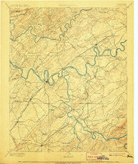
~ Loudon TN topo map, 1:125000 scale, 30 X 30 Minute, Historical, 1895, updated 1907
Loudon, Tennessee, USGS topographic map dated 1895.
Includes geographic coordinates (latitude and longitude). This topographic map is suitable for hiking, camping, and exploring, or framing it as a wall map.
Printed on-demand using high resolution imagery, on heavy weight and acid free paper, or alternatively on a variety of synthetic materials.
Topos available on paper, Waterproof, Poly, or Tyvek. Usually shipping rolled, unless combined with other folded maps in one order.
- Product Number: USGS-5339026
- Free digital map download (high-resolution, GeoPDF): Loudon, Tennessee (file size: 7 MB)
- Map Size: please refer to the dimensions of the GeoPDF map above
- Weight (paper map): ca. 55 grams
- Map Type: POD USGS Topographic Map
- Map Series: HTMC
- Map Verison: Historical
- Cell ID: 65939
- Scan ID: 153517
- Imprint Year: 1907
- Survey Year: 1891
- Datum: Unstated
- Map Projection: Unstated
- Map published by United States Geological Survey
- Map Language: English
- Scanner Resolution: 600 dpi
- Map Cell Name: Loudon
- Grid size: 30 X 30 Minute
- Date on map: 1895
- Map Scale: 1:125000
- Geographical region: Tennessee, United States
Neighboring Maps:
All neighboring USGS topo maps are available for sale online at a variety of scales.
Spatial coverage:
Topo map Loudon, Tennessee, covers the geographical area associated the following places:
- Lovell Heights - Buttermilk Shores - Concords Woods - Hiwassee College - Loudon - Harrison Hills - Phillips - Winslow - Sequoyah Heights - Mount Tabor - Philadelphia - Greenwood Heights - Selkirk (historical) - Tommotley (historical) - Macedonia - Robinson Mill - Coytee (historical) - Byington - Kries - Walker Subdivision - Allegheny Springs (historical) - Byrd Chapel - Middlebrook Acres - Meadowbrook - Hopewell Springs - Lakeland Subdivision - Mialoquo (historical) - Bent Tree - Trails End - New Midway - Pleasant Ridge - Paint Rock (historical) - Hidden Valley - Village Green - Lenoir City - Concord - Woodlawn - Green Meadow - Toqua - Madisonville - Bell Spring - Sugarlimb - Cherokee Heights - Piney Grove Mobile Home Park - Chestnut Hills - Springview - Brakebill (historical) - Busselltown - Trigonia - Crestwood Hills - Oxmore Hills - Pleasant View - Highland Hills - Deane Hill - Coal Hill - Kingston Woods - Griffitts (historical) - Scenic Point Estates - Citico Beach - Twin Springs - Craigmar (historical) - Northshore Woods - Tennessee (historical) - Three Points - Citico (historical) - King Arthur Court - Westavia Woods - Karns - Prospect - Mahoney Mill - Peninsular Estates - Westborough - Alleghany (historical) - Boyd - Martel - Hartland Estates - Woodland Trace - Green Valley - West Knoxville Mobile Park - Paint Rock Farm Lake Estates - McMullens - Chilhowey (historical) - West Hills - Centersville - Jena - Century Acres - Kensington - Scott Hills - Pine Grove - Westmoreland Heights - Station West - Lawnville - Riverside - Fox Fire - Scarboro - Dixie Lee Junction - Clover Hill Estates - Blair - Dyllis - Third Creek
- Map Area ID: AREA3635.5-84.5-84
- Northwest corner Lat/Long code: USGSNW36-84.5
- Northeast corner Lat/Long code: USGSNE36-84
- Southwest corner Lat/Long code: USGSSW35.5-84.5
- Southeast corner Lat/Long code: USGSSE35.5-84
- Northern map edge Latitude: 36
- Southern map edge Latitude: 35.5
- Western map edge Longitude: -84.5
- Eastern map edge Longitude: -84


