
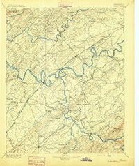
~ Loudon TN topo map, 1:125000 scale, 30 X 30 Minute, Historical, 1895
Loudon, Tennessee, USGS topographic map dated 1895.
Includes geographic coordinates (latitude and longitude). This topographic map is suitable for hiking, camping, and exploring, or framing it as a wall map.
Printed on-demand using high resolution imagery, on heavy weight and acid free paper, or alternatively on a variety of synthetic materials.
Topos available on paper, Waterproof, Poly, or Tyvek. Usually shipping rolled, unless combined with other folded maps in one order.
- Product Number: USGS-5339022
- Free digital map download (high-resolution, GeoPDF): Loudon, Tennessee (file size: 7 MB)
- Map Size: please refer to the dimensions of the GeoPDF map above
- Weight (paper map): ca. 55 grams
- Map Type: POD USGS Topographic Map
- Map Series: HTMC
- Map Verison: Historical
- Cell ID: 65939
- Scan ID: 153515
- Survey Year: 1891
- Datum: Unstated
- Map Projection: Unstated
- Map published by United States Geological Survey
- Map Language: English
- Scanner Resolution: 600 dpi
- Map Cell Name: Loudon
- Grid size: 30 X 30 Minute
- Date on map: 1895
- Map Scale: 1:125000
- Geographical region: Tennessee, United States
Neighboring Maps:
All neighboring USGS topo maps are available for sale online at a variety of scales.
Spatial coverage:
Topo map Loudon, Tennessee, covers the geographical area associated the following places:
- Fort Loudon Estates - Gooseneck - Canby Hills - Shady Grove - Bradbury - Hickory Hills - Hickory Woods - Woodland Trace - Rothwood - Moralfa - Mountainville (historical) - Lawnville Meadows - Paint Rock Farm Lake Estates - Jena - Concord - Byington - Griffitts (historical) - Hopewell Springs - Tommotley (historical) - Madisonville - Castaway Cove - Rambling Acres - Poplar Springs - Binfield - Westmoreland Heights - Pleasant Hills - Glendale - Kenmark Hills - Chota - Blair - Wooded Acres - Thornton - Hiwassee College - Rockville - Ebenezer - Holiday Hills - Meadow - West Knoxville Mobile Park - McGhee - Adolphus - Fairview Heights - Garland - Fagin - Caringer (historical) - Miser Station - Mialoquo (historical) - Volunteer Village - Union - Chilhowey (historical) - Alleghany (historical) - Crestwood Hills - Ball Camp - Morganton - Solway - Tan Rara Oesta - Highland Park - Tallassee - Martel Estates - Scenic Point Estates - Marmor - Maple Spring - Cloyd Creek (historical) - Wood - Clover Hill Estates - Big Springs - Davis - Armona - Century Acres - Vonore - Hamilton Subdivision - Farrington - Vancouver (historical) - Brick Mill - Belmont West - Wellsville - Marble Hill - Big Piney - Sunnyside - Blue Grass - Mentor - Westborough - Brashears Subdivision - Dixie Lee Junction - Walnut Hill Estates - Pine Grove - Northshore Woods - Windsor Park - Tuskeegee (historical) - Busselltown - Fairway Estates - Phillips - Sherril Heights - Union Grove - Edgewater Estates - Lawnville - Pawpaw Plains - Dyllis - West Hills - Sugarlimb - Bear (historical)
- Map Area ID: AREA3635.5-84.5-84
- Northwest corner Lat/Long code: USGSNW36-84.5
- Northeast corner Lat/Long code: USGSNE36-84
- Southwest corner Lat/Long code: USGSSW35.5-84.5
- Southeast corner Lat/Long code: USGSSE35.5-84
- Northern map edge Latitude: 36
- Southern map edge Latitude: 35.5
- Western map edge Longitude: -84.5
- Eastern map edge Longitude: -84


