
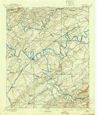
~ Loudon TN topo map, 1:125000 scale, 30 X 30 Minute, Historical, 1895, updated 1939
Loudon, Tennessee, USGS topographic map dated 1895.
Includes geographic coordinates (latitude and longitude). This topographic map is suitable for hiking, camping, and exploring, or framing it as a wall map.
Printed on-demand using high resolution imagery, on heavy weight and acid free paper, or alternatively on a variety of synthetic materials.
Topos available on paper, Waterproof, Poly, or Tyvek. Usually shipping rolled, unless combined with other folded maps in one order.
- Product Number: USGS-5339020
- Free digital map download (high-resolution, GeoPDF): Loudon, Tennessee (file size: 7 MB)
- Map Size: please refer to the dimensions of the GeoPDF map above
- Weight (paper map): ca. 55 grams
- Map Type: POD USGS Topographic Map
- Map Series: HTMC
- Map Verison: Historical
- Cell ID: 65939
- Scan ID: 149003
- Imprint Year: 1939
- Survey Year: 1891
- Datum: Unstated
- Map Projection: Polyconic
- Map published by United States Geological Survey
- Map Language: English
- Scanner Resolution: 600 dpi
- Map Cell Name: Loudon
- Grid size: 30 X 30 Minute
- Date on map: 1895
- Map Scale: 1:125000
- Geographical region: Tennessee, United States
Neighboring Maps:
All neighboring USGS topo maps are available for sale online at a variety of scales.
Spatial coverage:
Topo map Loudon, Tennessee, covers the geographical area associated the following places:
- Scarboro - Armona - Leedom (historical) - Concords Woods - Sugarlimb - Gravelly Hills - Woodchase - Rio Vista - Hardin Estates - Brashears Subdivision - Solway - Paint Rock Farm Lake Estates - Pleasant View - Heather Heights - Citico (historical) - Berkshire Wood - Carlton - Kensington - Northpoint - Martel Estates East - Westmoreland Heights - Glendale - Mahoney Mill - Kenmark Hills - Bradbury - Alleghany (historical) - Farrington - Fair Oaks - Bucktown - Old Glory - Big Springs - Woodlawn - Cusick - Forest Heights - Cumberland Estates - Peninsular Estates - Lawnville - Maple Spring - Sugar Grove - Little River (historical) - Rodgers Ridge Subdivision - Halfway Town (historical) - Hunting Hills West - Brakebill (historical) - Trails West - Old Sweetwater - Edington (historical) - Lakeland Subdivision - Hiwassee College - Montvue - Karns - Ten Mile - Country Estates Mobile Home Park - Robinson Crossroads - Wexford Downs - Paint Rock (historical) - Trigonia - Dogwood - Pleasant Ridge - Bear (historical) - Pumpkin Center - Chilhowee - Kinkaid (historical) - West Hills - Westlyn - Tuskeegee (historical) - Country Haven - Harrison Hills - Green Valley - Kries - Scott Hills - Deane Hill - Boyd - Tommotley (historical) - Miser Station - Lakewood - Beaver Creek Estates - Mount Zion - Arline - Philadelphia - Citico Beach - Lakeview - Mint - Dyllis - McMullens - Shaddon Mill - Orchard View - Oak Grove Heights - Christianburg - Lake-A-Wana - Garland - Twin Oaks - Ipe (historical) - Macedonia - Madisonville - Ebenezer - DeArmond - Tekoa - Binfield - Walker Subdivision
- Map Area ID: AREA3635.5-84.5-84
- Northwest corner Lat/Long code: USGSNW36-84.5
- Northeast corner Lat/Long code: USGSNE36-84
- Southwest corner Lat/Long code: USGSSW35.5-84.5
- Southeast corner Lat/Long code: USGSSE35.5-84
- Northern map edge Latitude: 36
- Southern map edge Latitude: 35.5
- Western map edge Longitude: -84.5
- Eastern map edge Longitude: -84


