
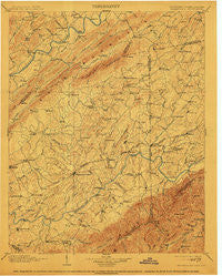
~ Greeneville TN topo map, 1:125000 scale, 30 X 30 Minute, Historical, 1904, updated 1913
Greeneville, Tennessee, USGS topographic map dated 1904.
Includes geographic coordinates (latitude and longitude). This topographic map is suitable for hiking, camping, and exploring, or framing it as a wall map.
Printed on-demand using high resolution imagery, on heavy weight and acid free paper, or alternatively on a variety of synthetic materials.
Topos available on paper, Waterproof, Poly, or Tyvek. Usually shipping rolled, unless combined with other folded maps in one order.
- Product Number: USGS-5338980
- Free digital map download (high-resolution, GeoPDF): Greeneville, Tennessee (file size: 8 MB)
- Map Size: please refer to the dimensions of the GeoPDF map above
- Weight (paper map): ca. 55 grams
- Map Type: POD USGS Topographic Map
- Map Series: HTMC
- Map Verison: Historical
- Cell ID: 65610
- Scan ID: 153443
- Imprint Year: 1913
- Survey Year: 1891
- Datum: Unstated
- Map Projection: Unstated
- Map published by United States Geological Survey
- Map Language: English
- Scanner Resolution: 600 dpi
- Map Cell Name: Greenville
- Grid size: 30 X 30 Minute
- Date on map: 1904
- Map Scale: 1:125000
- Geographical region: Tennessee, United States
Neighboring Maps:
All neighboring USGS topo maps are available for sale online at a variety of scales.
Spatial coverage:
Topo map Greeneville, Tennessee, covers the geographical area associated the following places:
- Green Acres - Glendale - Stacy - Applewalk Park - Couch (historical) - Dobson Subdivision - Mount Carmel - Derby (historical) - Chuckey - Liberty - Lyons Store (historical) - Saint James - Meadowbrook - Walkertown - Sirenburg (historical) - Horse Creek - Marvin - Westgate - Kepler - Morelock (historical) - Rock Springs - Strahl - Pleasant Valley - DeRusk - Walter Crossroad - Pleasant Vale - Bradburn Hill - Vernon Heights - Rockwood Hill - Buckingham Heights - Cherokee Estates - Hampton Mill - Castell Springs - Cherrydale - Hartshaw Subdivision - Eastview - Miller Flats - DeBusk - Wilhoit Subdivision - Zion Hill - Swanay (historical) - Pilot Knob - Union Temple - Haws Crossroads - Caney Branch - Belvins - Surgoinsville - Allenbridge (historical) - Windy Hills - Craft Spring - Colonial Acres - Phipps Bend - Taylor Acres - Flag Pond - Liberty Hill - Highland Hills - Pine Grove - Graham Mill - Kincheloe (historical) - Blue Ridge Estates - Oak Hill - Stowe Acres - Enterprise - Slaughter (historical) - Tusculum - Cloverbottom (historical) - Twin Oaks - Holly Hills - Bolton Estates - Pinecrest - Centersville - Gillenwater (historical) - Butcher (historical) - Deerfield - Longs Bend - Philadelphia - Summer Hills - Lone Star - Rollins Subdivision - Leesburg - Carmen - Albany - Dulaney - Fairfield - Vogel (historical) - Cedar Creek - Brittontown - College View - Bald Crossing - Summersville - Rustic Acres - Sulphur Springs - Robinson Forest - College Hills - Gilbreath - McPheeter Bend - Mill Brook - Guntown - Nolichucky (historical) - Burem
- Map Area ID: AREA36.536-83-82.5
- Northwest corner Lat/Long code: USGSNW36.5-83
- Northeast corner Lat/Long code: USGSNE36.5-82.5
- Southwest corner Lat/Long code: USGSSW36-83
- Southeast corner Lat/Long code: USGSSE36-82.5
- Northern map edge Latitude: 36.5
- Southern map edge Latitude: 36
- Western map edge Longitude: -83
- Eastern map edge Longitude: -82.5


