
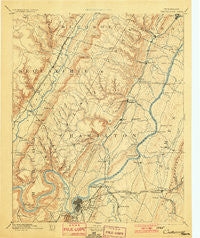
~ Chattanooga TN topo map, 1:125000 scale, 30 X 30 Minute, Historical, 1893, updated 1901
Chattanooga, Tennessee, USGS topographic map dated 1893.
Includes geographic coordinates (latitude and longitude). This topographic map is suitable for hiking, camping, and exploring, or framing it as a wall map.
Printed on-demand using high resolution imagery, on heavy weight and acid free paper, or alternatively on a variety of synthetic materials.
Topos available on paper, Waterproof, Poly, or Tyvek. Usually shipping rolled, unless combined with other folded maps in one order.
- Product Number: USGS-5338936
- Free digital map download (high-resolution, GeoPDF): Chattanooga, Tennessee (file size: 8 MB)
- Map Size: please refer to the dimensions of the GeoPDF map above
- Weight (paper map): ca. 55 grams
- Map Type: POD USGS Topographic Map
- Map Series: HTMC
- Map Verison: Historical
- Cell ID: 65175
- Scan ID: 153498
- Imprint Year: 1901
- Survey Year: 1886
- Datum: Unstated
- Map Projection: Polyconic
- Map published by United States Geological Survey
- Map Language: English
- Scanner Resolution: 600 dpi
- Map Cell Name: Chattnooga
- Grid size: 30 X 30 Minute
- Date on map: 1893
- Map Scale: 1:125000
- Geographical region: Tennessee, United States
Neighboring Maps:
All neighboring USGS topo maps are available for sale online at a variety of scales.
Spatial coverage:
Topo map Chattanooga, Tennessee, covers the geographical area associated the following places:
- Ware Branch - Holiday Hills - Pineoak Heights - Forest Meade - Falling Water - Irongate - Hampton Woods - Lake Vista - Capital Heights - Jones Mobile Home Park - Hickory Woods - Brush Creek - Washington Place - Poindexter Heights - Lake Hills - North Soddy - Crabtree Hills - Ooltewah - Savannah Hills - Echo Glen - Signal Mountain - Coulterville - Bluff View - Prairie Peninsula - Midvale - Mountain View - Lakeshor Manor - Fair Meadows Mobile Home Park - Huckleberry - Middle Valley Estates - Green Gables Mobile Home Park - Cartwright - Bushtown - Mile Straight - Country Oaks Estates - Lupton City - Tall Oaks Mobile Home Park - Cambridge Estates - Pine Hill - Acres of Shade Mobile Home Park - Valleybrook - Northshore Estates - Pinebrook Estates - Mimosa Trailer Park - Blaney Forest - Old Farm - Bakewell - Hamillville - Theresa Heights - Skiles (historical) - Cross Creek - Stoneridge - Radmoor - Savannah Peninsula - Fairfax Heights - Williamsburg Estates - Shelton Estates - Forest Hills - Lake Village - Brynewood Park - Pinetree Estates - Marimont - Skyline Park - Signal Hills - Rollingwood - Long Branch - Spring Valley - Summertown - Jersey - Plaza Hills - Soddy-Daisy - Hickory Grove - Hidden Hills Estates - Northshore Hills - Boyce - Edgemont Forest - Summit - Chattanooga - Port Serena - Engleton Heights - Riverview - Forest Park - Shake Rag - Alton Park - Fairhills - Sandalwood Village - Forest Highlands - Hixson - Morrison Springs - Hickory Valley - Dana Hills - Tuckegee (historical) - Hillcrest Estates - Stuart Heights - Brookfield - Moon Shadows - Mineral Park - Melville - Towne Hills - Norcross Hills
- Map Area ID: AREA35.535-85.5-85
- Northwest corner Lat/Long code: USGSNW35.5-85.5
- Northeast corner Lat/Long code: USGSNE35.5-85
- Southwest corner Lat/Long code: USGSSW35-85.5
- Southeast corner Lat/Long code: USGSSE35-85
- Northern map edge Latitude: 35.5
- Southern map edge Latitude: 35
- Western map edge Longitude: -85.5
- Eastern map edge Longitude: -85


