
~ Milan TN topo map, 1:100000 scale, 30 X 60 Minute, Historical, 1986, updated 1993
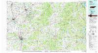
Milan, Tennessee, USGS topographic map dated 1986.
Includes geographic coordinates (latitude and longitude). This topographic map is suitable for hiking, camping, and exploring, or framing it as a wall map.
Printed on-demand using high resolution imagery, on heavy weight and acid free paper, or alternatively on a variety of synthetic materials.
Topos available on paper, Waterproof, Poly, or Tyvek. Usually shipping rolled, unless combined with other folded maps in one order.
- Product Number: USGS-5338876
- Free digital map download (high-resolution, GeoPDF): Milan, Tennessee (file size: 24 MB)
- Map Size: please refer to the dimensions of the GeoPDF map above
- Weight (paper map): ca. 55 grams
- Map Type: POD USGS Topographic Map
- Map Series: HTMC
- Map Verison: Historical
- Cell ID: 67954
- Scan ID: 148583
- Imprint Year: 1993
- Woodland Tint: Yes
- Aerial Photo Year: 1985
- Edit Year: 1986
- Datum: NAD27
- Map Projection: Universal Transverse Mercator
- Map published by Tennessee Valley Authority
- Map Language: English
- Scanner Resolution: 600 dpi
- Map Cell Name: Milan
- Grid size: 30 X 60 Minute
- Date on map: 1986
- Map Scale: 1:100000
- Geographical region: Tennessee, United States
Neighboring Maps:
All neighboring USGS topo maps are available for sale online at a variety of scales.
Spatial coverage:
Topo map Milan, Tennessee, covers the geographical area associated the following places:
- Floyville (historical) - Mousetail (historical) - Terry - Decaturville - Whitthorne - Spain (historical) - Youngs Crossing - Pond Branch - Cherokee Heights - Gibson - Stegall - Spring Creek - Chalklevel - Trenton - Robison - Rock Springs - Westwood Gardens - Concord - Reagan - Blankenship (historical) - Farmville (historical) - Palestine - Middle Fork - Perryville - Hickory Flat - Moores Chapel - Poplar Springs - Christian Chapel - Warrens Bluff - Birdsong Heights - Darden - Birdsong Creek Subdivision - Midway - Roy - Williams Chapel - Etna (historical) - Antioch - Smith - Broadway - Yellow Springs - Mifflin - Mason Grove - Scotts Hill - Mount Gilead - Beacon Junction - Holladay - Leach - Cotton Grove - Gadsden - Timberlake - Bargerton - Union Cross - Concord - Luray - Sitka - Windy City - Westport - Graball - Hicksville - Three Way - Poplar Springs - Maple Creek (historical) - Beacon - Russell Crossroads - Bible Hill - Yuma - McIllwain - Oakfield - Colwick (historical) - Lexington - New Shiloh - Sharon - Jackson Range Station - Hopewell - Hughes Loop - Oak Grove - Shady Hill - Lavinia - Atkins (historical) - Spanish Grove - Woodhill (historical) - Five Points - Wilkinstown - Lakewood - Mount Lebanon - Garrett - Camden Bay Subdivision - Mount Moriah - Rhodes Town - Neely - Mount Tabor - Life - Bear Creek - Center Hill - Five Forks - Busseltown - Buena Vista - Maple Grove - Adair - Howard
- Map Area ID: AREA3635.5-89-88
- Northwest corner Lat/Long code: USGSNW36-89
- Northeast corner Lat/Long code: USGSNE36-88
- Southwest corner Lat/Long code: USGSSW35.5-89
- Southeast corner Lat/Long code: USGSSE35.5-88
- Northern map edge Latitude: 36
- Southern map edge Latitude: 35.5
- Western map edge Longitude: -89
- Eastern map edge Longitude: -88


