
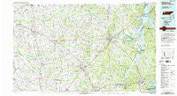
~ McKenzie TN topo map, 1:100000 scale, 30 X 60 Minute, Historical, 1986, updated 1993
McKenzie, Tennessee, USGS topographic map dated 1986.
Includes geographic coordinates (latitude and longitude). This topographic map is suitable for hiking, camping, and exploring, or framing it as a wall map.
Printed on-demand using high resolution imagery, on heavy weight and acid free paper, or alternatively on a variety of synthetic materials.
Topos available on paper, Waterproof, Poly, or Tyvek. Usually shipping rolled, unless combined with other folded maps in one order.
- Product Number: USGS-5338864
- Free digital map download (high-resolution, GeoPDF): McKenzie, Tennessee (file size: 22 MB)
- Map Size: please refer to the dimensions of the GeoPDF map above
- Weight (paper map): ca. 55 grams
- Map Type: POD USGS Topographic Map
- Map Series: HTMC
- Map Verison: Historical
- Cell ID: 72647
- Scan ID: 148571
- Imprint Year: 1993
- Woodland Tint: Yes
- Visual Version Number: 2
- Aerial Photo Year: 1981
- Edit Year: 1986
- Datum: NAD27
- Map Projection: Universal Transverse Mercator
- Map published by Tennessee Valley Authority
- Map Language: English
- Scanner Resolution: 600 dpi
- Map Cell Name: McKenzie
- Grid size: 30 X 60 Minute
- Date on map: 1986
- Map Scale: 1:100000
- Geographical region: Tennessee, United States
Neighboring Maps:
All neighboring USGS topo maps are available for sale online at a variety of scales.
Spatial coverage:
Topo map McKenzie, Tennessee, covers the geographical area associated the following places:
- Dresden - Blooming Grove - New Zion - China Grove - Georgetown - Porters (historical) - Eagle Hill - Faxon - Midway - Puryear - Idlewild - Oak Wood Estates - Gleason - Jarrell - Lipe - Woodland Acres - West Union - Buchanan - Hancock - Springville - Lakeview Manor - Bethel - Staffords Store - Beech Grove - Bradford - Enon - Como - Hinkledale - Pleasant Hill - Oak Hill - Beaverdam Creek Subdivision - Liberty - Crowley Store - Hollow Rock - Martin - Cherrywood - Brundige - Hico - Porter Court - McKenzie - Durham Subdivision - Pace (historical) - Meadow Mead - Camp Ground - Austin Springs - Buchanan Subdivision - Tin Cup - Henry - Liberty - Sawyers Mill - Bethlehem - Sandhill - Dunlap (historical) - Antioch Harbor Resort - Routon - Paris - Salem - Manleyville - Pierce Station - India - Glasgow (historical) - Mill Creek - Crossroads - Poplar Grove - Jones Mill - Tuckers Corner - Four Points - Barrons Corner - Dyer - Laneview - Chambers - Camden - Oak Haven Acres - Cabana Estates - Riverwood Hills - Pleasant Hill - Hilltop - Palmersville - Lick Creek - Haigler Ridge - New Hope - Holly Leaf - Chestnut Hill - Huntingdon - Ephesus - Midway - Jewell - Ruthville - Rutherford - Camp Ground - Gardner - Vale - Mixie - Freeland - Trezevant - Greenhills - Grizzard - Van Dyke - Chestnut Glade - McConnell
- Map Area ID: AREA36.536-89-88
- Northwest corner Lat/Long code: USGSNW36.5-89
- Northeast corner Lat/Long code: USGSNE36.5-88
- Southwest corner Lat/Long code: USGSSW36-89
- Southeast corner Lat/Long code: USGSSE36-88
- Northern map edge Latitude: 36.5
- Southern map edge Latitude: 36
- Western map edge Longitude: -89
- Eastern map edge Longitude: -88


