
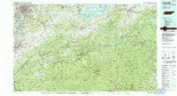
~ Knoxville TN topo map, 1:100000 scale, 30 X 60 Minute, Historical, 1983, updated 1984
Knoxville, Tennessee, USGS topographic map dated 1983.
Includes geographic coordinates (latitude and longitude). This topographic map is suitable for hiking, camping, and exploring, or framing it as a wall map.
Printed on-demand using high resolution imagery, on heavy weight and acid free paper, or alternatively on a variety of synthetic materials.
Topos available on paper, Waterproof, Poly, or Tyvek. Usually shipping rolled, unless combined with other folded maps in one order.
- Product Number: USGS-5338852
- Free digital map download (high-resolution, GeoPDF): Knoxville, Tennessee (file size: 31 MB)
- Map Size: please refer to the dimensions of the GeoPDF map above
- Weight (paper map): ca. 55 grams
- Map Type: POD USGS Topographic Map
- Map Series: HTMC
- Map Verison: Historical
- Cell ID: 67775
- Scan ID: 148001
- Imprint Year: 1984
- Woodland Tint: Yes
- Aerial Photo Year: 1981
- Edit Year: 1983
- Datum: NAD27
- Map Projection: Universal Transverse Mercator
- Map published by Tennessee Valley Authority
- Map Language: English
- Scanner Resolution: 600 dpi
- Map Cell Name: Knoxville
- Grid size: 30 X 60 Minute
- Date on map: 1983
- Map Scale: 1:100000
- Geographical region: Tennessee, United States
Neighboring Maps:
All neighboring USGS topo maps are available for sale online at a variety of scales.
Spatial coverage:
Topo map Knoxville, Tennessee, covers the geographical area associated the following places:
- Colonial Village - Maryville - Tryon - Kodak - Montvue - Line Spring - Newport - Ewing (historical) - Catlettsburg - Townsend - Seaton - New Hopewell - Walnut Grove - Ravensford - Castle Heights - Sandy Ridge - Crestmont - Willard Addition - Edgewood Acres - Lonsdale - Briarcliff - Mockingbird Hill - Meadowbrook - Cove Creek Cascades - Airport Plaza - Kimberlin Heights - Mimosa Estates - Knoxville - Bluffton - Ola - Sequoyah Hills - Lincoln Park - Pitner (historical) - English Creek - French Broad (historical) - Shady Grove - Vose - Shooks Gap - Sunset Gap - Wildwood - Creekwood - Greenbrier - Pine Grove - Cosby - Asbury - McMahan - Jackson Hills - Calderwood - Crockettsville - Shady Grove - Jonathan - Kinzel Springs - Buena Vista - Beech Springs - Texas Settlement (historical) - Benford Heights Addition - Cartertown - Park City - East Springbrook - Crenshaw - Ellejoy - Cook Mill - Baltimore - Cherokee Hills - Plainfield - Promised Land - West Millers Cove - Bungalow - Meadowood - Lakeview Estates - Starkeytown - Hatchertown - Lake Forest - Catons Grove - Greenbrier (historical) - Walland - Cove Creek - Lakemoor Hills - Hartford - Turnberry Vistas - South Knoxville - Rocky Branch - Scenic Terrace - Mount Sterling - Wear Valley - Wilton Springs - Montvale - Powder Springs (historical) - Spur Trailer Park - Mule Hollow - Three Forks - Mimosa Heights - Finney Patch - Blount Beach - Hubbard - Eggers Addition - Neubert Springs - Jenkins Mill - Carson Springs - Wimbledon
- Map Area ID: AREA3635.5-84-83
- Northwest corner Lat/Long code: USGSNW36-84
- Northeast corner Lat/Long code: USGSNE36-83
- Southwest corner Lat/Long code: USGSSW35.5-84
- Southeast corner Lat/Long code: USGSSE35.5-83
- Northern map edge Latitude: 36
- Southern map edge Latitude: 35.5
- Western map edge Longitude: -84
- Eastern map edge Longitude: -83


